Tranquil conditions and milder temperatures will start this week, but a powerful cold front will mark a shirt to cold and stormier weather.
TODAY THROUGH TOMORROW
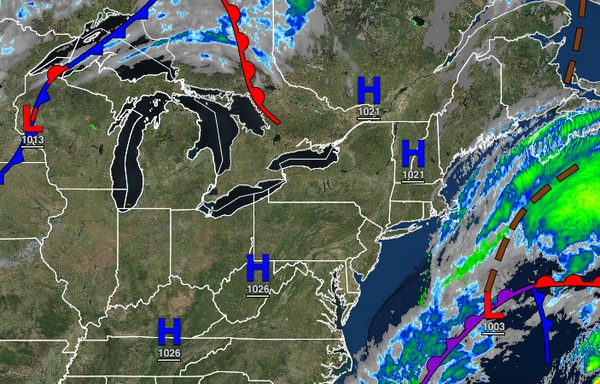
High pressure will be in control with clear skies to scattered cloud cover. Winds will back from the north to the west at 5 to 10 mph through the period. Temperatures will rise into the upper 50s to lower 60s over the interior and lower to mid-60s along the coast for highs today. Temperatures tomorrow will range from the lower to mid-40s for lows and upper 50s to lower 60s over the interior and mid to upper 60s along the coast for
highs.
WEDNESDAY
A weak cold front will pass through the region with scattered cloud cover expected. Winds will be from the west at 5 to 15 mph. Temperatures will range from the mid to upper 40s for lows and mid to upper 50s over the interior and lower to mid-60s along the coast for highs.
THURSDAY
High pressure will be in control with clear skies to scattered cloud cover. Temperatures will range from the lower to mid-30s over the interior and upper 30s to lower 40s along the coast for lows and lower to mid-50s over the interior and upper 50s to mid-60s along the coast for highs.
FRIDAY
A strong cold front will produce periods of rain throughout the region. The rain will be heavy at times. Temperatures will range from the lower to mid-50s over the interior and upper 50s to lower 60s along the coast for lows and mid to upper 50s over the interior and upper 50s to lower 60s along the coast for highs.
SATURDAY
High pressure will build south into the region with scattered clouds. Temperatures will range from the lower to mid-30s over the interior and mid to upper 30s along the coast for lows and mid to upper 50s over the interior and upper 50s to lower 60s along the coast for highs.
SUNDAY THROUGH MONDAY
An area of low pressure will develop over the coastal waters with scattered showers along the coast and a mix of rain and snow showers over the higher elevations. Temperatures will range from the upper 20s to lower 30s over the interior and mid to upper 30s along the coast for lows and upper 30s to mid-40s over the interior and upper 40s to lower 50s for highs.