An active weather pattern returns with a few flurries tonight, a wet Christmas morning, and an icy start to next week for the interior.
TODAY
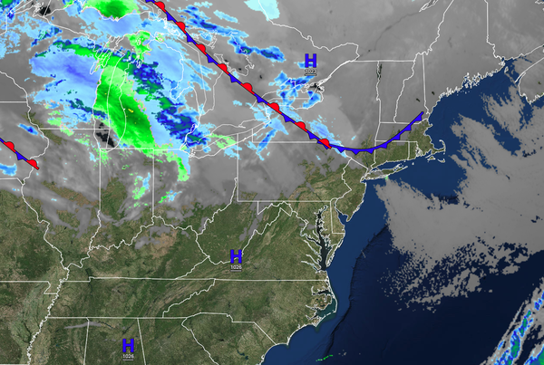
High pressure will produce scattered cloud cover through this afternoon. Winds from the northwest at 5 to 15 mph. Temperatures will rise into the lower to mid-30s for highs.
TONIGHT
A weak trough will pass through the region with a few flurries and isolated snow showers. Winds will be from the south at 5 to 15 mph. Temperatures will fall into the upper 20s to lower 30s for lows.
TOMORROW (CHRISTMAS EVE)
A warm front will approach the region with increasing clouds and scattered showers by the evening. A few flurries are possible over the interior. Winds will be from the west at 5 to 15 mph. Temperatures will rise into the lower to mid-40s over the interior and mid-40s to lower 50s along the coast for highs.
SATURDAY (CHRISTMAS)
An area of low pressure will follow with periods of showers through the morning into the afternoon. Skies will clear towards the evening. Winds will veer from the west to the northwest at 5 to 15 mph. Temperatures will range from the mid to upper 30s over the interior and lower to mid-40s along the coast for lows and mid to upper 40s over the interior and upper 40s to lower 50s along the coast for highs.
SUNDAY
Scattered clouds with windy conditions are expected. Temperatures will range from the lower to mid-30s over the interior and upper 30s to lower 40s along the coast for lows and upper 30s to lower 40s over the interior and lower to mid-40s along the coast for highs.
MONDAY
An area of low pressure will produce a wintry mix of snow, sleet, and freezing rain for higher elevations with some snow and ice accumulation possible. Periods of rain are expected along the coast. Temperatures will range from the mid to upper 20s over the interior and lower to mid-30s along the coast for lows and mid to upper 30s over the interior and lower to mid-40s along the coast for highs.
TUESDAY
Another area of low pressure will produce periods of rain. Temperatures will range from the lower to mid-30s for lows and upper 30s to lower 40s over the interior and lower to mid-40s along the coast for highs.
WEDNESDAY
A weak trough will support the development of scattered rain and snow showers over the region. Temperatures will range from the mid to upper 20s over the interior and lower to mid-30s along the coast for lows and mid to upper 30s for highs.
THURSDAY
Another low-pressure system will produce periods of snow, sleet, and rain. Temperatures will range from the lower to mid-30s over the interior and mid to upper 30s along the coast for lows and lower to mid-40s over the interior and mid to upper 40s along the coast.