TONIGHT
Scattered clouds with a few isolated rain and snow showers are expected. Winds will be from the west at 5 to 15 mph. Temperatures will hold around the lower to mid-30s over the interior and upper 30s to lower 40s along the coast for lows.
TOMORROW
Scattered clouds with a few isolated rain and snow showers are expected through tomorrow afternoon. Winds will veer to the northeast at 5 to 15 mph. Temperatures will rise into the upper 30s to lower 40s over the interior and mid-40s to lower 50s along the coast for highs.
TOMORROW NIGHT
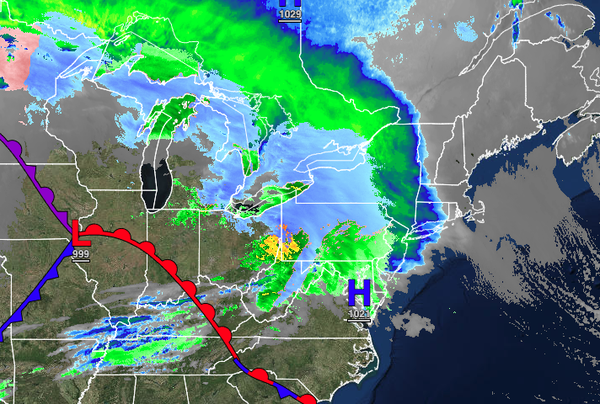
An area of low pressure will move through the region with periods of showers along the coast and periods of snow showers in the Poconos, Catskills, Hudson River Valley, and northwestern Connecticut with some light snowfall accumulation. Winds will be from the northeast at 5 to 15 mph. Temperatures will fall into the lower to mid-30s over the interior and upper 30s to lower 40s along the coast for lows.
WEDNESDAY
A weak trough will support the development of scattered rain and snow showers over the region. Winds will be from the northeast at 5 to 15 mph. Temperatures will rise into the lower to mid-40s over the interior and upper 40s to lower 50s along the coast for highs.
THURSDAY
Another low-pressure system will produce periods of snow, sleet, and rain over the interior and rain along the coast. Temperatures will range from the lower to mid-40s over the interior and mid to upper 40s along the coast for lows and mid-40s over the interior and upper 40s to mid-50s along the coast for highs.
FRIDAY
High pressure will produce scattered cloud cover. Temperatures will range from the mid to upper 30s over the interior and upper 30s to lower 40s along the coast for lows and mid to upper 40s over the interior and upper 40s to lower 50s along the coast for highs.
SATURDAY
Increasing clouds with a few widely scattered showers are expected as a cold front approaches. Temperatures will range from the lower to mid-40s for lows and upper 40s to lower 50s over the interior and lower to mid-50s along the coast for highs.
SUNDAY
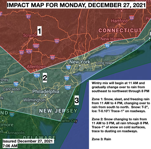
An area of low pressure will produce periods of snow, sleet, and rain over the interior and rain along the coast. The wintry mix and rain will gradually mix over to snow before ending. Some snow and ice accumulation is possible. Temperatures will range from the upper 20s to lower 30s over the interior and mid-30s to mid-40s along the coast for lows and mid to upper 40s over the interior and lower 50s to lower 60s along the coast for highs.
Temperatures will fall through the 40s, 30s, and 20s in the afternoon and evening hours.
MONDAY
Scattered clouds with lingering snow showers and flurries are expected. Temperatures will range from the lower to mid-10s over the interior and mid to upper 10s along the coast for lows and lower to mid-20s over the interior and mid to upper 20s along the coast for highs.