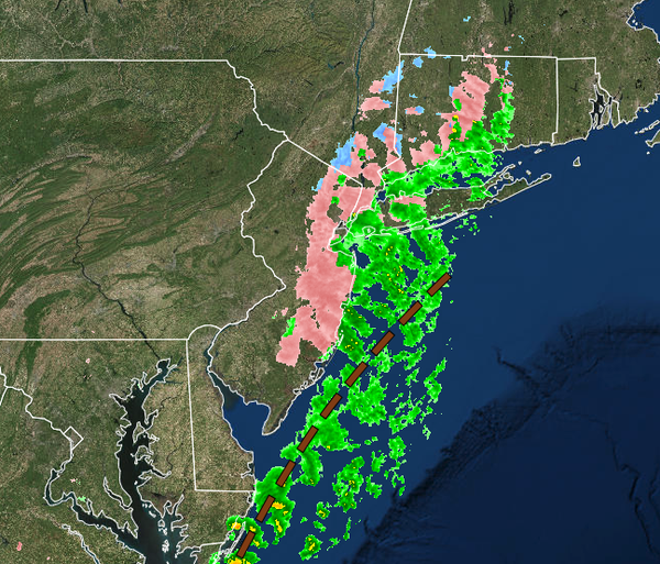
Freezing rain this morning has produced dangerous and icy road conditions this morning, especially throughout New Jersey. A snow threat becomes clearer for Friday morning.
TODAY
A trough of low pressure will continue to lift through the region with areas of freezing rain and rain this morning. Slick and icy road conditions are a high threat. A cold front will follow with isolated showers in the afternoon. Winds will be from the southwest at 5 to 15 mph. Temperatures will rise into the lower to mid-40s over the interior and upper 40s to lower 50s along the coast for highs.
TONIGHT
High pressure will build into the region with clearing skies. Winds will veer to the west at 5 to 15 mph. Temperatures will fall into the upper 10s to the lower 20s over the interior and mid-20s to lower 30s along the coast for lows.
TOMORROW
High pressure will be in control with scattered cloud cover. Clouds will increase in the evening with snow showers developing towards midnight. Winds will be from the west-northwest at 5 to 15 mph. Temperatures will rise into the upper 20s to lower 30s over the interior and lower to mid-30s along the coast for highs.
FRIDAY
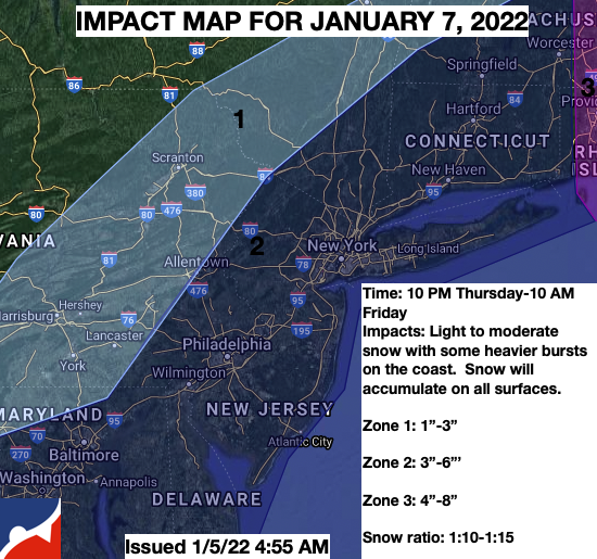
An area of low pressure will develop off the Mid Atlantic coast with periods of snow, possibly heavy at times along the coast. Details on the storm impacts are on the map below. The snow will exit in the morning with clearing skies by the afternoon. Winds will be from the northwest at 5 to 15 mph. Temperatures will range from lower to mid-20s over the interior and upper 20s to lower 30s along the coast for lows and upper 20s over the
interior and lower to mid-30s along the coast for highs.