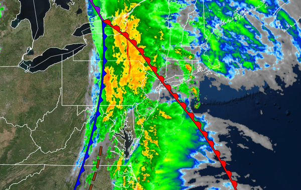
The strong cold front moving through the region this morning will mark a shift in a more active and colder weather pattern for the region.
TODAY
A strong cold front will produce periods of rain throughout the region from 4 AM to 2 PM. The rain will be heavy at times, especially in the morning hours. Skies will clear from west to east this afternoon. Winds will veer from the southeast to the west at 10 to 20 mph with gusts over 30 mph at times. Temperatures will rise into the mid to upper 50s over the interior and upper 50s to lower 60s along the coast for highs.
TONIGHT
Scattered clouds are expected ahead of another cold front approaching the region. Winds will be from the northwest at 5 to 15 mph. Temperatures will fall into the lower to mid-40s for lows.
TOMORROW
A strong cold front will move through the region tomorrow with widely scattered showers to scattered showers. Some snow and sleet may mix in with the rain for elevations above 1,000 feet but no accumulation is expected. Winds will be from the southeast at 5 to 15 mph. Temperatures will rise into the upper 40s to mid-50s over the interior and upper 50s to lower 60s along the coast for highs.
SUNDAY
A weak trough will pass through the region with isolated showers on the coast and isolated rain and snow showers over the interior. Winds will be from the southwest at 5 to 15 mph. Temperatures will range from the upper 20s to mid-30s over the interior and upper 30s to lower 40s along the coast for lows and lower to mid-40s over the interior and upper 40s to lower 50s along the coast for highs.
MONDAY
An area of low pressure will develop over the coastal waters with scattered showers along the coast and a mix of snow, sleet, and rain showers for the higher elevations above 1,000 feet. Snow accumulations of up to 2" are possible for elevation above 1,000 feet on cold surfaces. Temperatures will range from the lower to mid-30s over the interior and upper 30s to mid-40s along the coast for lows and upper 30s to lower 40s over the interior and mid-40s
to lower 50s along the coast for highs.
TUESDAY
A cold front will follow with isolated rain and snow showers. Temperatures will range from the upper 20s to mid-30s over the interior and mid to upper 30s along the coast for lows and upper 30s to lower 40s over the interior and mid to upper 40s along the coast for highs.
WEDNESDAY
High pressure will be in control with clear skies to scattered clouds. Temperatures will range from the upper 20s to lower 30s over the interior and lower to mid-30s along the coast for lows and upper 30s to lower 40s over the interior and mid to upper 40s along the coast for highs.
THURSDAY
A cold front will move through the region with scattered showers expected. Temperatures will range from the mid to upper 40s over the interior and upper 40s to lower 50s along the coast for lows and mid to upper 50s over the interior and upper 50s to lower 60s along the coast for highs.
FRIDAY
A wave of low pressure will develop along the cold front with periods of rain along the coast and a wintry mix of snow, sleet, and rain for elevations above 1,000 feet. Some snow accumulation will be possible for the highest elevations. Temperatures will range from the lower to mid-30s over the higher elevations, upper 30s to mid-40s in the suburbs, and mid to upper 40s along the coast for lows and mid-30s over the higher elevations, upper 40s to
mid-40s in the suburbs, and upper 40s to lower 50s along the coast for highs.