A powerful cold front will produce thunderstorms, strong winds, and falling temperatures today. The threat for snowfall increases for higher elevations.
TODAY
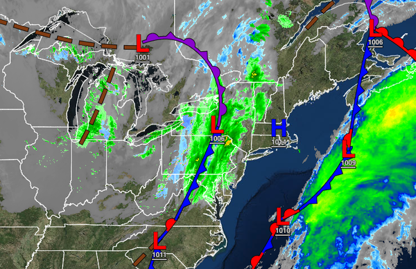
A strong cold front will move through the region with scattered showers and a few strong thunderstorms. There is potential for a few isolated severe thunderstorms with intense downpours, frequent lightning, wind gusts over 40 mph, and an isolated tornado for northeastern New Jersey, southeastern New York, and Connecticut. Winds will veer from the southeast to the west at 10 to 20 mph with gusts over 30 mph at times, especially for the New Jersey
coast. Temperatures will rise into the upper 40s to mid-50s over the interior and upper 50s to lower 60s along the coast for highs.
TONIGHT
Scattered clouds are expected with a few isolated rain and snow showers. Winds will be from the west at 5 to 15 mph. Temperatures will fall into the upper 20s to lower 30s over the interior and mid to upper 30s along the coast for lows.
TOMORROW
A weak trough will pass through the region with isolated showers on the coast and isolated rain and snow showers over the interior. Winds will be from the southwest at 5 to 15 mph. Temperatures will range from the upper 20s to mid-30s over the interior and upper 30s to lower 40s along the coast for lows and lower to mid-40s over the interior and upper 40s to lower 50s along the coast for highs.
TOMORROW NIGHT THROUGH MONDAY
An area of low pressure will develop over the coastal waters with scattered showers along the coast and a mix of snow, sleet, and rain showers for the higher elevations above 1,000 feet. Snow accumulations of up to 3" are possible for elevation above 1,000 feet on cold surfaces tomorrow night through Monday morning before mixing over to rain. Winds will be from the west at 10 to 20 mph. Temperatures will range from the lower to mid-30s over the
interior and upper 30s to mid-40s along the coast for lows and upper 30s to lower 40s over the interior and mid-40s to lower 50s along the coast for highs.
TUESDAY
A cold front will follow with isolated rain and snow showers. Temperatures will range from the upper 20s to mid-30s over the interior and mid to upper 30s along the coast for lows and upper 30s to lower 40s over the interior and mid to upper 40s along the coast for highs.
WEDNESDAY
High pressure will be in control with clear skies to scattered clouds. Temperatures will range from the upper 20s to lower 30s over the interior and lower to mid-30s along the coast for lows and upper 30s to lower 40s over the interior and mid to upper 40s along the coast for highs.
THURSDAY
A cold front will move through the region with scattered showers expected. Temperatures will range from the mid to upper 40s over the interior and upper 40s to lower 50s along the coast for lows and mid to upper 50s over the interior and upper 50s to lower 60s along the coast for highs.
FRIDAY
A wave of low pressure will develop along the cold front with periods of rain along the coast and a wintry mix of snow, sleet, and rain for elevations above 1,000 feet. Some snow accumulation will be possible for the highest elevations. Temperatures will range from the lower to mid-30s over the interior and upper 30s to lower 40s along the coast for lows and mid to upper 30s over the interior and lower to mid-40s along the coast for highs.
SATURDAY
High pressure will produce scattered cloud cover. Temperatures will range from the mid to upper 20s over the interior, upper 20s to lower 30s in the suburbs, and lower to mid-30s along the coast for lows and lower to mid-40s over the interior and mid to upper 40s along the coast for highs.