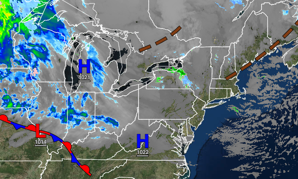
High pressure will provide tranquil conditions and warmer weather the next few days, but another strong cold front approaches. Meanwhile, a storm is brewing just before Thanksgiving.
TODAY
High pressure will produce scattered clouds through this afternoon. Winds will be from the west at 5 to 15 mph. Temperatures will rise into the lower to mid-40s over the interior and mid to upper 40s along the coast for highs.
TONIGHT THROUGH TOMORROW
High pressure will produce clear skies to scattered clouds. Winds will be from the southwest at 5 to 15 mph. Temperatures will range from the upper 20s to lower 30s over the interior and lower to mid-30s along the coast for lows and upper 40s to mid-50s over the interior and upper 50s to mid-60s along the coast for highs.
THURSDAY
A cold front will approach the region with increasing clouds and showers developing in the afternoon and evening hours. Winds will be from the southwest at 5 to 15 mph. Temperatures will range from the mid to upper 40s over the interior and lower to mid-50s along the coast for lows and lower to mid-60s for highs.
FRIDAY
The cold front will clear the region in the morning with periods of showers. Some sleet and snow may mix in at the very end of the precipitation over the higher elevations. Scattered clouds are expected in the afternoon. Windy conditions are expected. Temperatures will range from the lower to mid-30s over the interior and upper 30s to lower 40s along the coast for lows and upper 30s to lower 40s over the interior and mid to upper 40s along
the coast for highs.
SATURDAY AND SUNDAY
High pressure will be in control with clear skies to scattered cloud cover. Temperatures on Saturday will range from the mid to upper 20s over the interior and lower to mid-30s along the coast for lows and lower to mid-40s for highs. Temperatures on Sunday will range from the mid to upper 30s for lows and lower to mid-40s over the interior and upper 40s to mid-50s along the coast for highs.
MONDAY
A cold front will produce scattered showers. Temperatures will range from the mid to upper 30s over the interior and lower to mid-40s along the coast for lows and mid to upper 40s over the interior and lower to mid-50s along the coast for highs.
TUESDAY
An area of low pressure will intensify over the coastal waters with periods of rain, mixing with snow and sleet at times over the higher elevations. Strong wind gusts will be a threat. Temperatures will range from the lower to mid-30s over the higher elevations, upper 30s to mid-40s in the suburbs, and upper 40s to mid-50s along the coast for lows and mid to upper 30s over the higher elevations, mid to upper 40s in the suburbs, and lower to mid-50s
along the coast for highs.