Tranquil conditions, for now, will give way to a colder, more active weather pattern just in time for Thanksgiving.
TODAY
High pressure will produce clear skies to scattered clouds. Winds will be from the southwest at 5 to 15 mph. Temperatures will rise into the upper 40s to mid-50s over the interior and upper 50s to mid-60s along the coast for highs.
TONIGHT THROUGH TOMORROW
A cold front will approach the region with increasing clouds and showers developing by tomorrow evening. Winds will be from the southwest at 5 to 15 mph. Temperatures will range from the mid to upper 40s over the interior and lower to mid-50s along the coast for lows and lower to mid-60s for highs.
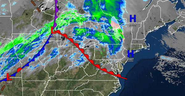
TOMORROW NIGHT
The cold front will move through the region with periods of showers expected, mixing with some sleet and snow for elevations above 1,000 feet at times. No accumulation is expected. Winds will veer from the southwest to the northwest at 5 to 15 mph. Temperatures will fall into the lower to mid-30s over the interior and upper 30s to lower 40s along the coast for lows.
FRIDAY
The cold front will clear the region in the morning with a few lingering rain and snow showers. Scattered clouds are expected in the afternoon. Winds will be from the northwest at 10 to 20 mph with gusts up to 35 mph possible. Temperatures will rise into the upper 30s to lower 40s over the interior and mid to upper 40s along the coast for highs.
SATURDAY AND SUNDAY
High pressure will be in control with clear skies to scattered cloud cover. Temperatures on Saturday will range from the mid to upper 20s over the interior and lower to mid-30s along the coast for lows and lower to mid-40s for highs. Temperatures on Sunday will range from the mid to upper 30s for lows and lower to mid-40s over the interior and upper 40s to mid-50s along the coast for highs.
MONDAY
A cold front will produce periods of rain, heavy at times. Temperatures will range from the mid to upper 40s over the interior and lower to mid-50s along the coast for lows and lower to mid-50s over the interior and mid to upper 50s along the coast for highs.
TUESDAY
An area of low pressure will intensify over the coastal waters with periods of rain, mixing with snow and sleet at times over the higher elevations in the morning hours. Strong wind gusts will be a threat. Lingering rain and snow showers are expected through the afternoon and evening. Temperatures will range from the upper 20s to lower 30s over the interior and mid to upper 30s along the coast for lows and mid-30s to lower 40s over the interior
and lower to mid-40s along the coast for highs.
WEDNESDAY
Scattered clouds are expected with windy conditions. A few snow showers will be a threat for the Poconos and Catskills with minor snow accumulation. Temperatures will range from the mid to upper 20s over the interior and lower to mid-30s along the coast for lows and mid to upper 30s over the interior and lower to mid-40s along the coast for highs.