Excellent weather for Thanksgiving but a shift in the weather pattern begins tomorrow morning. The first snowfall of the year is becoming likely by Sunday for many locations.
TODAY
High pressure will exit the region with increasing clouds throughout the day. Winds will be from the west at 5 to 15 mph. Temperatures will range from the upper 20s to mid-30s for lows and mid to upper 40s over the interior and lower to mid-50s along the coast for highs.
TONIGHT THROUGH TOMORROW
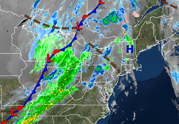
A strong cold front will follow with periods of rain, mixing with sleet and snow at times for the higher elevations tonight through tomorrow morning hours. Scattered clouds with lingering flurries and snow showers are expected in the afternoon. Winds will veer to the northwest at 10 to 20 mph with gusts up to 30 mph at times. Temperatures will range from the mid to upper 30s over the interior and lower to mid-40s along the coast for lows and
upper 30s to lower 40s over the interior and mid to upper 40s along the coast for highs.
SATURDAY
A series of troughs and cold fronts will pass through the region with scattered clouds and flurries. Some steadier snow showers will be a threat for the Poconos and Catskills with minor snow accumulation. Winds will be from the northwest at 10 to 20 mph with gusts up to 30 mph possible. Temperatures on Saturday will range from the lower to mid-20s over the interior and upper 20s to lower 30s along the coast for lows and lower to mid-30s over the
interior and upper 30s to lower 40s along the coast for highs.
SUNDAY
An area of low pressure will develop off the New Jersey coastal waters and rapidly exit, producing a period of light snow away from the coast and a wintry mix of snow, sleet, and rain along the coast in the afternoon and evening hours. All precipitation will mix over to snow before ending on Sunday night. Minor snow accumulation will be possible, with snow accumulation of 1" to 3" for elevations above 700 feet and a trace to an inch below 700 feet.
Temperatures on Sunday will range from the mid to upper 20s over the interior and upper 20s to lower 30s along the coast for lows and lower to mid-30s over the interior and upper 30s to mid-40s along the coast for highs.
MONDAY
A series of troughs and cold fronts will pass through the region with scattered clouds and flurries. Some steadier snow showers will be a threat for the Poconos and Catskills with minor snow accumulation. Temperatures on Monday will range from the lower to mid-20s over the interior and upper 20s along the coast for lows and upper 20s to lower 30s over the interior and mid to upper 30s along the coast for highs.
TUESDAY
An area of low pressure and cold front will approach with scattered showers along the coast and a mix of rain and snow showers changing over to snow showers over the interior. Temperatures will range from the lower to mid-20s over the interior and upper 20s to lower 30s along the coast for lows and mid to upper 30s over the interior, upper 30s to lower 40s in the suburbs, and mid to upper 40s along the coast for highs.
WEDNESDAY AND THURSDAY
High pressure will produce tranquil weather conditions with scattered cloud cover. Temperatures on Wednesday will range from the mid to upper 20s over the interior and lower to mid-30s along the coast for lows and mid to upper 30s over the interior and lower to mid-40s along the coast for highs. Temperatures on Thursday will range from the lower to mid-10s over the higher elevations, upper 10s to mid-20s in the suburbs, and lower to mid-20s along the
coast for lows and upper 20s to lower 30s over the interior and mid to upper 30s along the coast for highs.