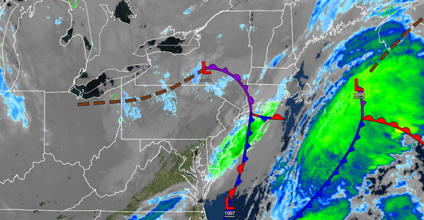
A series of frontal passages will move through the region throughout this week, keeping the threat for rain and snow showers in the forecast each day. A more significant storm is possible by early next week.
TODAY
A cold front will clear the coast this morning with a few lingering flurries followed by scattered cloud cover this afternoon. Winds will be from the northwest at 5 to 15 mph. Temperatures will rise into the lower to mid-30s over the interior and upper 30s to lower 40s along the coast for highs.
TONIGHT THROUGH TOMORROW
A series of weak troughs will pass through the region with scattered clouds and a few isolated rain and snow showers. Winds will back from the northwest to the west at 5 to 15 mph. Temperatures will range from the lower to mid-20s over the interior and mid to upper 20s along the coast for lows and lower to mid-30s over the interior and upper 30s to lower 40s along the coast for highs.
WEDNESDAY
Another weak trough front will follow with scattered clouds and isolated rain and snow showers. Winds will back from the west to the southwest at 5 to 15 mph. Temperatures will range from the upper 20s to lower 30s for lows and upper 30s to lower 40s over the interior and mid-40s along the coast for highs.
THURSDAY
An area of low pressure will force a warm front through the region in the morning hours with a wintry mix of rain and snow for higher elevations and rain along the coast followed by additional showers in the afternoon and evening with the cold front passage. Temperatures will range from the mid to upper 30s over the interior and lower to mid-40s along the coast for lows and upper 40s to lower 50s over the interior and mid to upper 50s along the coast for
highs.
FRIDAY AND SATURDAY
A series of cold fronts will follow with scattered clouds and isolated rain and snow showers. Temperatures on Friday will range from the upper 20s to lower 30s over the interior and mid to upper 30s along the coast for lows and upper 30s to lower 40s over the interior and mid to upper 40s along the coast for highs. Temperatures on Saturday will range from the lower to mid-30s over the interior and mid to upper 30s along the coast for lows and upper 30s
to lower 40s over the interior, lower to mid-40s along the coast, and mid to upper 40s in the Delaware River Valley for highs.
SUNDAY
High pressure will pass over the region with scattered cloud cover. Temperatures will range from the lower to mid-20s over the interior and mid to upper 20s along the coast for lows and lower to mid-30s over the interior and mid-30s to lower 40s along the coast for highs.
MONDAY
An area of low pressure will produce periods of rain along the coast and the major metropolitan areas and a wintry mix of snow, sleet, and rain for the higher elevations in the afternoon and evening hours. Temperatures will range from the upper 20s to lower 30s over the interior and lower to mid-30s along the coast for lows and upper 30s to mid-40s over the interior and mid-40s to lower 50s along the coast for highs.