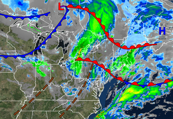
The mild start to December continues today, but a shift to a colder, active weather pattern is likely to return by next week.
TODAY
An area of low pressure will force a warm front through the region in the morning hours with periods of showers followed by additional showers in the afternoon and evening with the cold front passage. Winds will veer from the southwest to the west at 5 to 15 mph. Temperatures will rise into the upper 40s to lower 50s over the interior and mid to upper 50s along the coast for highs.
TONIGHT THROUGH TOMORROW
A series of cold fronts will follow with scattered clouds and isolated rain and snow showers. Temperatures will range from the lower to mid-30s over the interior and mid to upper 30s along the coast for lows and mid to upper 30s over the interior, upper 30s to lower 40s in the New York City metropolitan areas, and mid to upper 40s in the Philadelphia metropolitan areas for highs.
SATURDAY
High pressure will build into the region with clear skies to scattered cloud cover. Winds will be from the northwest at 5 to 15 mph. Temperatures will range from the mid-20s to lower 30s over the interior, mid to upper 30s in the New York City metropolitan area, and upper 30s to lower 40s in the Philadelphia metropolitan area for lows and mid to upper 40s over the interior and upper 40s to mid-50s along the coast for highs.
SUNDAY
High pressure will pass over the region with scattered cloud cover. Temperatures on Sunday will range from the lower to mid-20s over the interior and mid to upper 20s along the coast for lows and upper 30s to mid-40s over the interior, mid-40s to lower 50s in the Delaware River Valley, and lower to mid-50s along the coast for highs.
MONDAY
A strong cold front will move through the region with periods of rain throughout the region. Temperatures will range from the lower to mid-40s over the interior and upper 40s to lower 50s along the coast for lows and upper 40s to lower 50s over the interior and mid-50s to lower 60s along the coast for highs.
TUESDAY
High pressure will produce clear skies to scattered cloud cover. Temperatures will range from the lower to mid-20s over the interior and upper 20s to lower 30s along the coast for lows and lower to mid-30s over the interior and mid to upper 30s over the interior for highs.
WEDNESDAY
A strong cold front with a wave of low pressure will produce periods of rain along the coast and a wintry mix of snow and sleet over the interior. Temperatures will range from the upper 20s to lower 30s for lows and lower to mid-30s over the interior and upper 30s to lower 40s along the coast for highs.
THURSDAY
High pressure will produce clear skies to scattered cloud cover. Temperatures will range from the lower to mid-20s over the interior and upper 20s to lower 30s along the coast for lows and lower to mid-30s over the interior and mid to upper 30s along the coast for highs.