We all are ready for Spring, but old man winter is going to be visiting this weekend with rain, snow, and freezing temperatures.
TODAY
High pressure will produce clear skies to scattered cloud cover. Winds will be from the southeast at 5 to 15 mph. Temperatures will rise into the upper 40s to lower 50s over the interior and along the coast and mid to upper 50s in the Delaware River Valley for highs.
TONIGHT
Clouds will steadily increase as a cold front and wave of low-pressure approach the region. Winds will be from the southeast at 5 to 15 mph. Temperatures will fall into the mid-20s to lower 30s over the interior and mid-30s to lower 40s along the coast for lows
TOMORROW
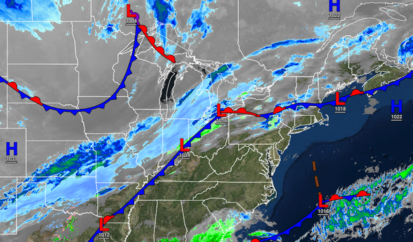
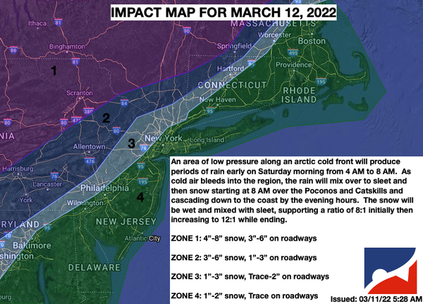
A strong area of low pressure will produce periods of rain, heavy at times, mixing over to snow before ending from west to east. Significant snowfall is expected for higher elevations with over 6" of snow expected. Mostly rainfall is expected for the Delaware River Valley and to the east, but some minor snow accumulation will be possible on cold surfaces before ending. Winds will back from the southeast to the northwest at 10 to 20 mph with gusts
over 30 mph. Temperatures will rise into the lower to mid-30s over the interior and upper 30s to lower 50s along the coast for highs. Temperatures are expected to peak in the morning hours and then fall throughout the afternoon into the 30s and 20s.