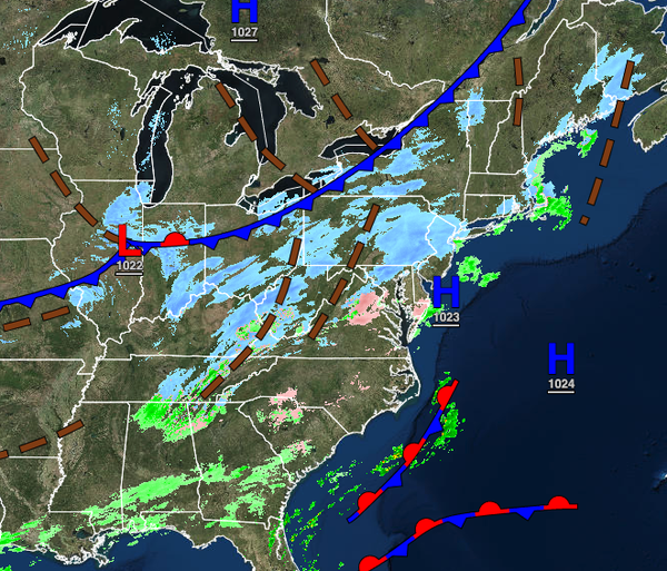
An arctic cold front today will set the stage for a dangerous winter storm for much of the region with heavy snow, strong winds, and visibility below a mile.
TODAY
An arctic cold front will approach from the west while an area of low pressure will organize over the coastal waters which will produce scattered snow showers through this evening. Winds will veer from the southwest to the northwest at 5 to 15 mph. Temperatures will rise into the upper 20s to lower 30s over the interior and lower to mid-30s along the coast for highs.
TONIGHT
Steady light to moderate snow will develop throughout much of the region. Scattered snow showers can be expected in the Poconos and Catskills. Winds will back to the northeast at 10 to 20 mph with gusts over 30 mph at times. Temperatures will rapidly fall into the single digits over the interior to the mid-10s along the coast for lows
TOMORROW
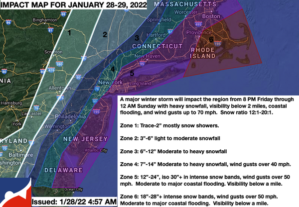
An area of low pressure will intensify east of the coastal water with periods of snow, heavy at times, on the coast and snow showers over the interior. There is a high threat for blizzard conditions on the coast with wind gusts up to 50 mph and visibility near zero. Details on what to expect are on the map below. A shift in the storm track to the west or east would have a significant impact on the outcome of the storm. Winds will back from
the northeast to the northwest at 10 to 20 mph with gusts at times over 30 mph. Coastal flooding will be a concern with potentially moderate to major impacts. Temperatures will rise into the mid-10s over the interior to the lower 20s along the coast for highs.