Warm conditions, fog, and showers today will give way to crash temperatures and a wintry mix by tomorrow morning. A tranquil weather pattern returns for next week.
TODAY
A strong cold front will approach with locally dense fog in the morning hours giving way to overcast skies and periods of showers through the afternoon and evening. Steady rain is expected at night. Winds will be from the south at 5 to 15 mph. Temperatures will rise into the lower to mid-40s over the interior and upper 40s to lower 50s along the coast for highs.
TOMORROW
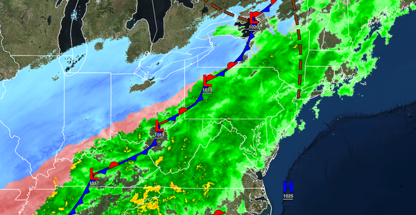
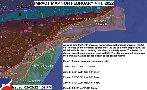
An arctic cold front with waves of low pressure will slowly move through the region with periods of rain mixing over to sleet and snow from northwest to southeast throughout the day. Snow and ice accumulation will be likely north and northwest of the I-95 corridor, especially for higher elevations. Slick roadways and poor visibility are expected. Winds will veer from the south to the northwest at 5 to 15 mph with gusts up to 20 mph at
times. Temperatures will fall through the 50s and 40s into the 20s throughout the day into the evening hours.