Heavy rain and strong winds linger through tonight. Unsettled conditions continue through next week as the low-pressure system lingers off the coast.
TODAY
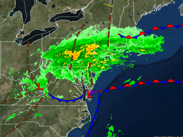
An area of low pressure will produce periods of heavy rain throughout the day. Winds will be from the east at 10 to 20 mph, with gusts over 40 mph at times. Rainfall amounts of 1" to 3" will be possible for the Philadelphia and New York City metropolitan areas. Flash flooding, coastal flooding, minor wind damage, and power outages will be a threat. Temperatures will rise into the upper 40s to lower 50s over the interior and lower to mid-50s
along the coast for highs.
TONIGHT
Steady rainfall will taper off from north to south, but scattered showers and drizzle will linger through tomorrow morning. Winds will be from the northeast at 10 to 20 mph, with gusts up to 40 mph at times. Temperatures will fall into the mid to upper 30s over the interior and lower to mid-40s along the coast for lows.
TOMORROW
The low-pressure system will drop to the south with scattered clouds with isolated showers over the interior and broken cloud cover with widely scattered showers over the rest of the region. Winds will be from the northeast at 10 to 20 mph. Temperatures will rise into the lower to mid-50s for highs.
MONDAY
The area of low pressure will produce scattered to broken clouds with isolated to widely scattered showers. Temperatures will range from the upper 30s to mid-40s for lows and lower to mid-60s for highs.
TUESDAY AND WEDNESDAY
Scattered clouds with isolated showers can be expected. Temperatures on Tuesday will range from the upper 30s to mid-40s for lows and mid-60s for highs. Temperatures on Wednesday will range from the lower to mid-40s over the interior and mid to upper 40s along the coast for lows and mid to upper 60s along the coast and upper 60s to lower 70s away from the coast for highs.
THURSDAY THROUGH SATURDAY
A coastal warm front will slowly approach from the Atlantic Ocean with scattered to broken cloud cover and isolated showers over the interior and scattered showers along the coast. Temperatures on Thursday will range from the upper 40s to mid-50s for lows and upper 60s to lower 70s along the coast and lower to mid-70s away from the coast for highs. Temperatures on Friday will range from the mid to upper 50s for lows and lower to mid-70s for highs.
Temperatures on Saturday will range from the mid-50s to lower 60s for lows and upper 60s to lower 70s along the coast and lower to mid-70s away from the coast for highs.