While showers will remain a lingering threat through the rest of the week, conditions will improve by this weekend.
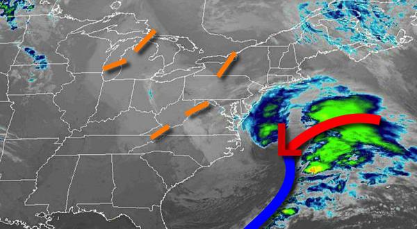
A series of weak troughs will rotate through the region today on through Friday with scattered to broken cloud cover and isolated showers. Winds will be from the northwest at 5 to 15 mph, gusting to 20 mph at times. Temperatures this afternoon will rise into the lower to mid-50s for highs. Temperatures tomorrow will range from the lower to mid-30s for lows and lower to mid-50s over the interior and mid to upper 50s along the coast
for highs. Temperatures on Friday will range from the upper 30s to lower 40s for lows and lower to mid-50s for highs.
High pressure will be in control on Saturday and Sunday with clear skies to scattered cloud cover. Temperatures on Saturday will range from the lower to mid-40s for lows and mid to upper 50s for highs. Temperatures on Sunday will range from the mid to upper 30s for lows and lower to mid-60s for highs.
A series of cold fronts will follow on Monday and Tuesday will produce scattered clouds and isolated showers. Temperatures on Monday will range from the mid to upper 40s for lows and lower to mid-60s over the interior, mid-50s to lower 60s on Long Island, and mid to upper 60s elsewhere for highs. Temperatures on Tuesday will range from the upper 30s to lower 40s for lows and upper 50s to lower 60s for highs.