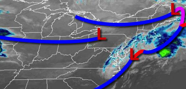
A cold front will clear the coast this morning with lingering showers this morning. A series of additional cold fronts and troughs will follow through this week, producing cool and unsettled conditions.
As one cold front exits, another will follow this afternoon with scattered to broken cloud cover and isolated showers. Winds will be from the northwest at 10 to 20 mph. Temperatures will rise into the lower to mid-60s over the interior and mid-60s to lower 70s along the coast.
A weak trough is expected tomorrow with scattered clouds and isolated showers. Winds will be from the northwest at 5 to 15 mph. Temperatures will range from the mid to upper 30s over the interior and lower to mid-40s along the coast for lows and mid-50s to lower 60s for highs.
An area of low pressure will approach on Wednesday with scattered to broken cloud cover and isolated showers. Winds will be from the northeast at 5 to 10 mph. Temperatures will range from the upper 30s to lower 40s over the interior and mid to upper 40s along the coast for lows and lower to mid-50s for highs.
A series of weak cold fronts will follow on Thursday and Friday with scattered cloud cover and isolated showers. Temperatures on Thursday will range from the mid-30s to lower 40s for lows and upper 50s to lower 60s for highs. Temperatures on Friday will range from the upper 30s to mid-40s for lows and mid to upper 50s over the interior and upper 50s to mid-60s along the coast for highs.
High pressure will be in control on Saturday and Sunday with clear skies to scattered cloud cover. Temperatures on Saturday will range from the lower to mid-30s for lows and mid to upper 40s for highs. Temperatures on Sunday will range from the lower to mid-3os over the interior and upper 30s to lower 40s along the coast for lows and lower to mid-40s over the interior and upper 40s to mid-50s along the coast for
highs.