Showers will linger as a low-pressure system pulls away. Excellent weather is on the way for the weekend before another round of unsettled weather conditions.
TODAY
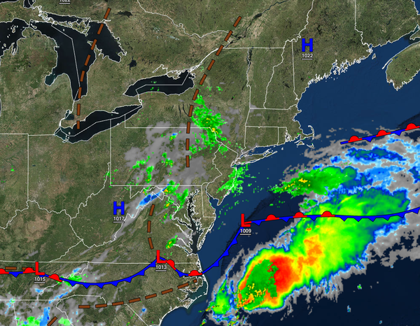
The low-pressure system will exit the region today with scattered showers this
morning, giving way scattered clouds and isolated showers in the afternoon. Winds will be from the northeast at 5 to 15 mph. Highs will be in the mid to upper 60s over the interior and lower to mid-70s along the coast for highs.
TONIGHT
A weak trough will produce scattered clouds and isolated showers. Winds will be from the northeast at 5 to 15
mph. Temperatures will fall into the lower to mid-60s for lows.
TOMORROW
A trough will linger over the region with scattered cloud cover and isolated showers. Winds will be from the northeast at 5 to 15 mph. Temperatures will rise into the mid to upper 70s along the coast, mid to upper 70s over the interior, and upper 70s to lower 80s in the
Delaware River Valley for highs.
TOMORROW NIGHT
High pressure will produce clear skies to scattered clouds. Winds will be from the northeast at 5 to 15 mph. Temperatures will fall into the upper 50s to lower 60s for lows.
FRIDAY
High
pressure will produce clear skies with a few clouds. Winds will be light and variable. Temperatures will rise into the upper 70s to lower 80s for highs.
SATURDAY
High pressure will produce clear skies with a few clouds. Temperatures will range from the upper 50s to lower 60s over the interior and lower to mid-60s along the coast for lows and upper 70s
to lower 80s over the interior, upper 70s to lower 80s along the coast, and lower to mid-80s in the Delaware River Valley for highs.
SUNDAY
A stationary front will produce scattered clouds with isolated showers. Temperatures will range from the lower to mid-60s for lows and upper 70s to lower 80s over the interior, upper 70s to lower 80s along the coast, and lower
to mid-80s in the Delaware River Valley for highs.
MONDAY
A stationary front will produce scattered clouds with isolated showers. Temperatures will range from the lower to mid-60s over the interior and mid to upper 60s along the coast for lows and upper 70s to lower 80s over the interior and lower to mid-80s along the coast for
highs.
TUESDAY
A wave of low pressure along the stationary front will produce scattered showers. Temperatures will range from the lower to mid-60s over the interior and mid to upper 60s along the coast for lows and upper 70s to lower 80s over the interior, upper 70s to lower 80s along the coast, and mid to upper 80s in the Delaware River Valley for
highs.
WEDNESDAY
A cold front will produce scattered showers. Temperatures will range from the mid to upper 60s over the interior and upper 60s to lower 70s along the coast for lows and lower to mid-70s over the interior and upper 70s to lower 80s along the coast for highs.