An area of low pressure will bring rain and even some higher elevation snowfall by this evening. Chilly weather conditions follow by this with a threat for frost and freeze conditions.
An area of low pressure will approach the region today with overcast skies and showers developing in the afternoon. Winds will be from the southwest at 5 to 10 mph. Temperatures will rise into the upper 40s to lower 50s over the interior and mid-50s to lower 60s along the coast.
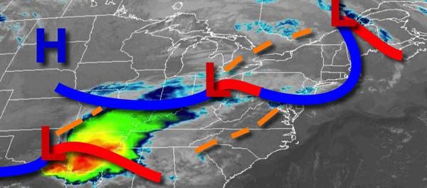
As the area of low pressure passes through the coastal waters this evening through tomorrow morning, periods of rain can be expected throughout the region. Snow will mix in with the rain and gradually change over to all snow for the higher elevations in the Poconos, Catskills, and northern Connecticut with a trace to 2" of snow is expected on cold surfaces. A few isolated locations may reach 3" on cold surfaces. Winds will back to the
northwest at 5 to 15 mph. Temperatures will fall into the upper 20s to lower 30s over the interior and mid-30s along the coast for lows.
As the area of low-pressure exits and high pressure builds in, skies will slowly clear tomorrow. A few snow flurries will be a threat to northeast Pennsylvania, Hudson River Valley, and northwestern Connecticut. Winds will be from the northwest at 10 to 20 mph with gusts over 30 mph. Temperatures will rise into the lower to mid-40s over the interior and mid to upper 40s along the coast for highs.
High pressure will pass over the region on Sunday with clear skies to scattered clouds. Winds will be from the west at 10 to 20 mph. Temperatures will range from the lower to mid-30s over the interior and mid to upper 30s along the coast for lows and mid-50s to lower 60s for highs.
An area of low pressure will pass through the region on Monday with isolated to widely scattered showers. Temperatures will range from the upper 30s to lower 40s over the interior and mid to upper 40s along the coast for lows and upper 50s to mid-60s for highs.
High pressure will produce clear skies to scattered cloud cover on Tuesday and Wednesday. Temperatures on Tuesday will range from the mid-30s to lower 40s for lows and upper 40s to lower 50s over the interior and mid to upper 50s along the coast for highs. Temperatures on Wednesday will range from the lower to mid-30s over the interior and mid to upper 30s along the coast for lows and mid-50s to lower 60s for highs.
A cold front will approach and stall over the region on Thursday with increasing clouds and scattered showers. Temperatures on Thursday will range from the lower to mid-30s over the interior and upper 30s to lower 40s along the coast for lows and lower to mid-50s over the interior, upper 50s to mid-60s in the New York City metro, and mid-60s to lower 70s in the Philadelphia metro for highs.