An area of low pressure will bring more rainfall to the region, but a pattern change is evolving that will bring much warmer weather conditions to the region, especially by the end of the week!
An area of low pressure will move through the region today with scattered to broken cloud cover and isolated to widely scattered showers. A few showers will be capable of break heavy downpours. Winds will be from the west at 5 to 15 mph. Temperatures will rise into the mid to upper 50s for highs this afternoon.
High pressure will build into the region tonight with clearing skies. Winds will be from the northwest at 5 to 15 mph. Temperatures will fall into the mid to upper 30s over the interior and upper 30s to lower 40s along the coast for lows.
High pressure will continue to build into the region tomorrow with scattered cloud cover to clear skies. Winds will be from the northwest at 10 to 20 mph with gusts up to 30 mph. Temperatures will rise into the lower to mid-50s over the interior and mid to upper 50s along the coast for highs.
High pressure will pass over the region on Wednesday with clear skies to a few clouds. Winds will be from the northwest at 5 to 15 mph. Temperatures will range from the lower to mid-30s over the interior and mid to upper 30s along the coast for lows and mid-50s to lower 60s for highs.
High pressure will exit on Thursday with increasing clouds throughout the day. A warm front will follow in the evening with isolated showers. Temperatures on Thursday will range from the lower to mid-30s over the interior and mid to upper 30s along the coast for lows and upper 50s to mid-60s for highs.
A cold front will approach on Friday with scattered showers and a few isolated thunderstorms. Temperatures on Friday will range from the upper 40s to lower 50s over the interior and mid to upper 50s along the coast for lows and lower to mid-70s over the interior, mid-70s to lower 80s in the New York City metro, and upper 70s to lower 80s in the Philadelphia metro for highs.
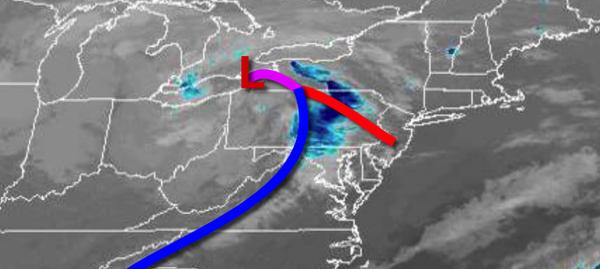
The cold front boundary will stall and waver over the region on Saturday and Sunday with scattered to broken cloud cover and scattered showers and thunderstorms. Temperatures will range widely depending on the position of the frontal boundary that day. Temperatures to the north of the stationary front will range from the upper 40s to mid-50s for lows and mid-60s to lower 70s for highs. Temperatures to the south of the stationary front
will range from the upper 50s to mid-60s for lows and mid-70s to lower 80s for highs.