As Tropical Storm Arthur exits into the Atlantic Ocean, windy conditions can be expected this afternoon along with a rogue isolated shower or two. Onshore winds will remain a theme for much of this week.
High pressure to the north and the departing Tropical Storm Arthur to the south will produce scattered to broken cloud cover and an isolated shower through this afternoon. Winds will be from the northeast at 10 to 20 mph with gusts over 25 mph at times, especially along the coast. Temperatures will rise into the lower to mid-60s for highs this afternoon.
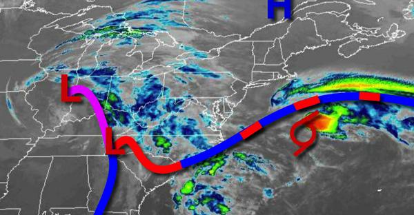
An intensifying low-pressure system over the Tennessee River Valley and high pressure over New England will produce scattered to broken cloud cover and isolated showers tonight on through Thursday. Winds will veer from the northeast to east at 5 to 15 mph. Temperatures tomorrow will range from the mid to upper 40s for lows and upper 50s to lower 60s for highs. Temperatures on Thursday will range from the upper 30s to lower 40s over the
interior and mid to upper 40s along the coast for lows and mid-50s to lower 60s along the coast and lower to mid-60s over the interior for highs.
The area of low pressure will approach on Friday with increasing cloud cover and isolated showers. The low-pressure system will move through the region Friday night through Saturday with isolated to widely scattered showers. A few showers will be capable of brief heavy downpours. Temperatures on Friday will range from the lower to mid-40s over the interior and mid-40s to lower 50s along the coast for lows and upper 60s to lower 70s for
highs. Temperatures on Saturday will range from the upper 40s to lower 50s over the interior and mid to upper 50s along the coast for lows and lower to mid-70s along the coast and mid to upper 70s over the interior for highs.
A series of weak cold fronts will follow on Sunday and Monday with scattered cloud cover and isolated showers. Temperatures on Sunday will range from the upper 40s to lower 50s for lows and lower to mid-60s along the coast and mid to upper 60s over the interior for highs. Temperatures on Monday will range from the lower to mid-40s over the interior and upper 40s to lower 50s along the coast for lows and lower to mid-60s on Long Island and
upper 60s to lower 70s elsewhere for highs.