An area of low pressure will bring periods of rain to the region for the first half of the Memorial Day Weekend, but the whole weekend is not a washout.
An area of low pressure will approach the region today with increasing clouds and showers developing this afternoon. Showers will become widespread and heavy at times this evening. Winds will be from the east at 5 to 10 mph. Temperatures will rise into the upper 60s to lower 70s for highs this afternoon.
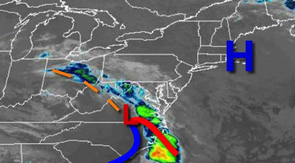
The area of low pressure will pass through southern New Jersey and south of Long Island tonight on through tomorrow afternoon with widespread showers, heavy at times. Rainfall amounts of 0.50" to 1.50" are expected with locally higher amounts possible. Winds will back from the east to northeast at 5 to 15 mph. Temperatures tomorrow will range from the upper 50s to lower 60s for lows and mid-60s to lower 70s for highs.
High pressure will build into the region from the Canadian Maritimes tomorrow night on through Memorial Day Monday with scattered to broken cloud cover. Winds will be from the east at 5 to 15 mph. Temperatures on Sunday will range from the mid to upper 40s over the interior and upper 40s to lower 50s along the coast for lows and upper 50s to mid-60s for highs. Temperatures on Memorial Day Monday will range from the mid-40s to lower 50s
for lows and lower to mid-60s for highs.
A stalled cold front to the west and a high-pressure system over the Atlantic Ocean will produce scattered to broken cloud cover and a threat for an isolated shower at any time for Tuesday on through Thursday. Temperatures through the forecast period will range from the mid-50s to lower 60s for lows and mid to upper 60s on Long Island and upper 60s to mid-70s elsewhere for highs.