A burst of summer heat will return to the region today and tomorrow before a cold front with heavy rain invades on Thursday. A persistent easterly is expected to produce cooler and cloudier weather by this weekend.
High pressure will push off the coast today with clear skies to scattered cloud cover. Winds will be from the southwest at 5 to 10 mph. Temperatures will rise into the mid-70s to lower 80s on the coast and mid to upper 80s elsewhere for highs.
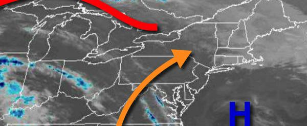
As high pressure exits the region and a cold front approaches from the west, clouds will be on the increase tonight on through tomorrow evening. Winds will be from the south at 5 to 15 mph. Temperatures tomorrow will range from the lower to mid-60s for lows and lower to mid-70s on Long Island, upper 70s to mid-80s along the coast, and mid-80s to lower 90s in the Delaware River Valley and eastern Pennsylvania.
A strong cold front will approach tomorrow night into Thursday morning with overcast skies and isolated to widely scattered showers. Winds will be from the south at 5 to 15 mph. Temperatures will fall into the mid-60s to lower 70s for lows on Thursday morning.
The cold front will move through the region on Thursday afternoon with periods of showers and thunderstorms. The thunderstorms will be capable of frequent lightning, heavy downpours, and wind gusts over 40 mph. Flash flooding will be a concern with rainfall amounts ranging from 0.25" to 1.25" with locally higher amounts possible. Winds will veer to the west as the cold front moves through at 5 to 15 mph. Temperatures will rise into
the mid-70s to lower 80s for highs.
The cold front will stall off the coast Thursday night on through Monday while weak waves of low-pressure develop along the boundary and pass through the coastal waters which will produce scattered to broken cloud cover, isolated showers, and a persistent northeast to easterly wind through the period. Temperatures on Friday will range from the upper 50s to lower 60s for lows and mid-70s to lower 80s for highs. Temperatures on Saturday will
range from the mid-50s to lower 60s for lows and mid-70s to lower 80s for highs. Temperatures on Sunday will range from the mid to upper 50s for lows and upper 60s to mid-70s for highs. Temperatures on Monday will range from the mid to upper 50s for lows and mid to upper 60s for highs.