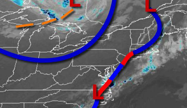
After another cold front passes through the region today, a maritime air mass will take control for this weekend with cooler but still pleasant weather conditions expected.
A cold front stall off the coast this morning will continue to produce isolated showers and areas of fog and low clouds along the coast, meanwhile, skies are clearing over the interior. Another cold front will follow this afternoon with scattered clouds and an isolated shower possible. Winds will be from the northwest at 5 to 15 mph. Temperatures will rise into the upper 70s to mid-80s for highs this afternoon.
A stationary boundary off the coast with waves of low pressure and high pressure to the north of the region will be in control tonight on through Sunday with scattered to broken cloud cover and isolated showers. Areas of fog will be a threat in the morning hours. Winds will veer from the north to east at 5 to 15 mph. Temperatures tomorrow will range from the lower to mid-50s for lows and upper 60s to mid-70s for highs. Temperatures
on Sunday will range from the mid-40s to lower 50s for lows and lower to mid-70s for highs.
The maritime air mass will remain in place through much of next week with a threat for isolated showers, otherwise scattered to broken cloud cover can be expected. Areas of fog will be a threat each morning. Temperatures will slowly moderate through the period. Temperatures on Monday and Tuesday will range from the upper 40s to mid-50s for lows and lower to mid-70s for highs. Temperatures on Wednesday and Thursday will range from
the upper 40s to mid-50s for lows and mid-70s to lower 80s for highs.
For details on your location, please visit the Local Seven Day Forecast.