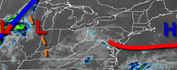
An unsettled weather pattern will be in place through this weekend with locally dense fog in the morning and a threat for showers and thunderstorms in the afternoon.
Areas of morning fog will give way to scattered to broken cloud cover by noon throughout the region. Isolated to widely scattered showers and thunderstorms will develop through the afternoon hours. The thunderstorms will be capable of brief heavy downpours, occasional lightning, and wind gusts over 30 mph. Winds will be from the south at 5 to 10 mph. Temperatures will rise into the mid-70s to lower 80s for
highs.
Areas of fog will redevelop tonight and linger through tomorrow morning along with a few isolated showers. Winds will be from the south at 5 to 10 mph. Temperatures will fall into the lower to mid-60s for lows.
After the fog lifts tomorrow morning, scattered to broken cloud cover is expected with isolated to widely scattered showers and thunderstorms. Winds will be from the south at 5 to 10 mph. Temperatures will rise into the upper 70s to mid-80s for highs.
As a trough lingers over the region on Sunday, areas of fog in the morning will give way to scattered to broken cloud cover and isolated to widely scattered showers and thunderstorms. Winds will be from the southeast at 5 to 15 mph. Temperatures will range from the lower to mid-60s for lows and upper 70s to mid-80s for highs.
As a cold front slowly approaches from the west and a trough of low pressure lingers over the region, areas of fog will be a threat in the morning hours and scattered showers and thunderstorms will form in the afternoon hours for Monday on through Wednesday. Temperatures on Monday will range from the lower to mid-60s for lows and upper 70s to mid-80s on the coast and mid to upper 80s elsewhere for highs. Temperatures on Tuesday and Wednesday
will range from the mid-60s to lower 70s for lows and upper 70s to lower 80s on Long Island and mid-80s to lower 90s for highs.
The cold front will move through on Thursday with scattered showers and thunderstorms. Temperatures on Thursday will range from the upper 50s to lower 60s for lows and upper 70s to mid-80s for highs.
For details on your location please visit the Local Seven Day Forecast!