After tranquil conditions this morning, a weak wave of low pressure will produce a few pesky showers this afternoon. A severe thunderstorm threat is brewing for Saturday evening.
An area of low pressure will organize off the coast along the stalled cold front over the coastal waters producing an increase in cloud cover and a few isolated showers, especially along the coast this afternoon and evening. Winds will be from west southwest at 5 to 15 mph. Temperatures will rise into the upper 70s to mid-80s for highs.
Scattered clouds are expected tonight on through tomorrow morning with clear skies to scattered cloud cover. Winds will be from the west-southwest at 5 to 10 mph. Temperatures will fall into the upper 50s to mid-60s for lows.
A weak trough will pass through the region tomorrow afternoon with a few isolated showers in the afternoon. Otherwise, scattered clouds can be expected. Winds will be from the southwest at 5 to 15 mph. Temperatures tomorrow will rise into the upper 70s to mid-80s for highs.
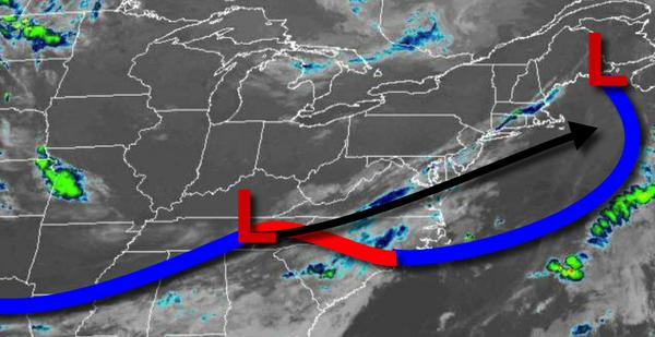
A strong cold front will approach the region on Saturday with locally dense fog in the morning followed by scattered showers and isolated severe thunderstorms in the evening. The thunderstorms will be capable of intense downpours, frequent lightning, wind gusts over 40 mph, and hail. Winds will be from the southwest at 10 to 20 mph. Temperatures on Saturday will range from the upper 50s to mid-60s for lows and mid-80s to lower 90s for
highs.
The cold front will slowly sink south on Sunday with widely scattered showers a threat. Temperatures on Sunday will range from the upper 60s to mid-70s for lows and mid-80s to lower 90s for highs.
High pressure will be in control on Monday with scattered cloud cover expected. Temperatures on Monday will range from the mid to upper 60s for lows and mid-80s to lower 90s for highs.
A weak trough will move through on Tuesday with a few isolated to widely scattered showers and thunderstorms. Otherwise, areas of fog in the morning will give way to scattered cloud cover in the afternoon. Temperatures on Tuesday will range from the upper 50s to mid-60s for lows and mid to upper 80s for highs.
A cold front will move through on Wednesday with scattered showers and thunderstorms. Temperatures on Wednesday will range from the upper 50s to mid-60s for lows and upper 70s to mid-80s for highs.
For details on your location, please visit the Local Seven Day Forecast.