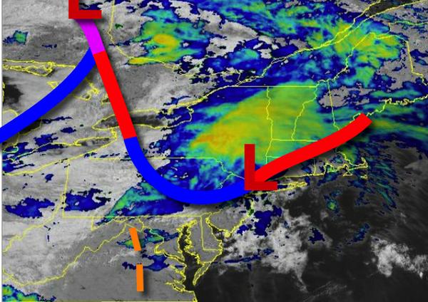
A series of frontal boundaries this weekend will produce showers and thunderstorms with the strongest thunderstorms a threat for this evening.
This morning, a warm front is lifting through the region with showers capable of heavy downpours at times. Once the warm front lifts through, muggy conditions can be expected. A cold front will approach later this afternoon, after 3 PM, with showers and strong to severe thunderstorms through 10 PM this evening. The thunderstorms will be capable of heavy downpours, frequent lightning, hail, and wind gusts over 60 mph. An isolated
tornado is possible, especially in eastern Pennsylvania and western New Jersey. Winds will be from the southwest at 10 to 20 mph. Temperatures will rise into the mid-70s to lower 80s in the New York City metro and mid-80s to lower 90s in the Philadelphia metro for highs this afternoon.
The cold front will slowly sink south through the region tomorrow with scattered to broken cloud cover and scattered showers capable of brief heavy downpours. Winds will veer to the west at 5 to 15 mph. Temperatures will range from the upper 60s to lower 70s for lows and mid-70s to lower 80s in the New York City metro and interior and mid-80s to lower 90s in the Philadelphia metropolitan area.
A weak trough will linger over the region on Monday with scattered to broken clouds and isolated to widely scattered showers, especially in the afternoon. Winds will be from the northwest at 5 to 15 mph. Temperatures on Monday will range from the mid to upper 60s for lows and upper 70s to lower 80s on the coast and mid to upper 80s elsewhere for highs.
A series of weak troughs will rotate through the region on Tuesday through Thursday with scattered to broken clouds and a threat for isolated showers and thunderstorms each day. Temperatures through the period will range from the upper 50s to mid-60s for lows and mid-70s to lower 80s on the coast and lower to mid-80s elsewhere for highs.
An approaching cold front from New England will produce scattered clouds with isolated thunderstorms in the evening. Temperatures on Friday will range from the mid to upper 60s for lows and upper 70s to mid-80s on Long Island and Connecticut and mid-80s to lower 90s elsewhere for highs.
For details on your location, please visit the Local Seven Day Forecast!