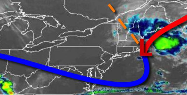
An unsettled weather pattern will continue through the short week and into the Fourth of July weekend with showers and thunderstorms a threat each afternoon.
A weak trough will approach the region today with scattered cloud cover expected. An isolated shower is possible in the afternoon hours. Winds will be from the northwest at 5 to 10 mph. Temperatures will rise into the upper 70s to mid-80s on the coast and mid-80s to lower 90s elsewhere for highs.
Scattered clouds are expected tonight with fog developing towards tomorrow morning in some location. Winds will veer to the northeast at 2 to 5 mph. Temperatures will fall into the upper 50s to mid-60s for lows.
A weak trough will linger over the region with scattered to broken cloud cover and widely scattered showers. Winds will be from the northeast at 2 to 5 mph. Temperatures tomorrow will rise into the mid-70s to lower 80s on the coast and mid-80s to lower 90s elsewhere for highs.
A weak trough will shift towards the Delaware River Valley on Wednesday with scattered to broken cloud cover and scattered showers capable of heavy downpours at times. Winds will veer to the southeast at 2 to 5 mph. Temperatures will range from the upper 50s to mid-60s for lows and mid-70s to lower 80s on the coast and lower to mid-80s to lower 90s elsewhere for highs.
Another trough will drop south from New England on Thursday with scattered clouds and isolated to widely scattered showers. Temperatures on Thursday will range from the lower to mid-60s for lows and upper 70s to mid-80s for highs.
Ahead of a strong cold front over New England, a hot and humid air mass will build into the region with scattered clouds and isolated thunderstorms on Friday. Temperatures will range from the mid-60s to lower 70s for lows and lower to mid-80s on Long Island, mid-80s to lower 90s in the New York City metro, and lower to mid-90s in the Delaware River Valley for highs.
A cold front will drop south on Saturday, Fourth of July, with scattered clouds and isolated showers. Temperatures on Saturday will range from the upper 60s to lower 70s for lows and mid-70s to lower 80s on the coast and mid-80s to lower 90s in the Delaware River Valley.
The cold front will stall over the Delaware River Valley on Sunday with scattered to broken cloud cover and isolated to widely scattered showers and thunderstorms. Temperatures will range from the lower to mid-60s for lows and upper 70s to mid-80s along the coast and mid-80s to lower 90s elsewhere for highs.
For details on your location, please visit the Local Seven Day Forecast!