...FLASH FLOOD WATCH IN EFFECT FROM FRIDAY MORNING THROUGH FRIDAY
EVENING...

The National Weather Service in Upton has issued a

* Flash Flood Watch for Southern Connecticut, Northeast New
  Jersey, the Lower Hudson Valley, New York City and Long Island.

* From Friday morning through Friday evening.

* Heavy rain showers and embedded thunderstorms are forecast
  Friday into Friday evening. A total of 1 to 3 inches of rainfall
  is forecast with locally higher amounts possible. Torrential
  rainfall within a short period of time will be possible and this
  could lead to flooding of low lying, urban and poor drainage
  areas. Some smaller streams and rivers could exceed bankfull.
The National Weather Service in Albany has issued a

* Flash Flood Watch for portions of northwestern Connecticut...
  western Massachusetts and east central New York, including the
  following areas, in northwestern Connecticut, Northern Litchfield
  and Southern Litchfield. In western Massachusetts, Northern
  Berkshire and Southern Berkshire. In east central New York,
  Eastern Columbia, Eastern Dutchess, Eastern Greene, Eastern
  Ulster, Western Columbia, Western Dutchess, Western Greene and
  Western Ulster.

* From Friday afternoon through Saturday morning

* Tropical low pressure moving up the mid Atlantic coastline will
  bring periods of showers to the region Friday afternoon through
  Saturday morning.  Rainfall rates may reach up to one inch per
  hour.

* Heavy rainfall falling in a short duration of time will allow for
  potential flooding of poor drainage and low lying areas. Flash
  flooding will be possible in urban areas as well.
...FLASH FLOOD WATCH IN EFFECT FROM MIDNIGHT EDT TONIGHT THROUGH
FRIDAY AFTERNOON...
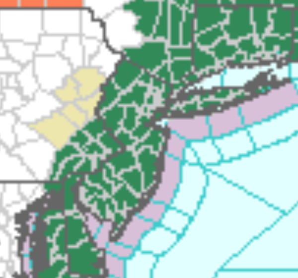
The National Weather Service in Mount Holly has issued a
* Flash Flood Watch for portions of Delaware, northeast
Maryland, and southern New Jersey, including the following
areas, in Delaware, Delaware Beaches, Inland Sussex, and Kent.
In northeast Maryland, Caroline, Kent MD, Queen Annes, and
Talbot. In southern New Jersey, Atlantic, Atlantic Coastal
Cape May, Cape May, Coastal Atlantic, and Cumberland.
* From midnight EDT tonight through Friday afternoon
* Heavy rain associated with a coastal low is expected to start
late tonight and continue through Friday morning. Widespread
amounts of 1 to 3 inches are likely with locally higher amounts
possible.
...FLASH FLOOD WATCH IN EFFECT FROM LATE TONIGHT THROUGH FRIDAY
EVENING...

The National Weather Service in Mount Holly has issued a

* Flash Flood Watch for portions of northern Delaware, northeast
  Maryland, New Jersey, and southeast Pennsylvania, including
  the following areas, in northern Delaware, New Castle. In
  northeast Maryland, Cecil. In New Jersey, Camden, Coastal
  Ocean, Eastern Monmouth, Gloucester, Hunterdon, Mercer,
  Middlesex, Morris, Northwestern Burlington, Ocean, Salem,
  Somerset, Southeastern Burlington, Sussex, Warren, and Western
  Monmouth. In southeast Pennsylvania, Delaware, Eastern
  Chester, Eastern Montgomery, Lower Bucks, Philadelphia, Upper
  Bucks, Western Chester, and Western Montgomery.

* From late tonight through Friday evening

* Heavy rain associated with a coastal low is expected to start
  very late tonight and continue through the day on Friday.
  Widespread amounts of 1 to 2 inches are likely with locally
  higher amounts possible.