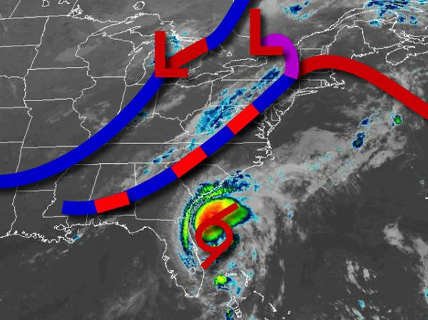
A weakening Tropical Storm Isaias will lift towards the region through tomorrow afternoon with waves of rainfall and embedded thunderstorms. The center of Isaias will move through the region in the late afternoon through evening hours with intense rainfall and strong winds backing from the south to the northeast at 10 to 20 mph over the interior and 20 to 50 mph sustained with higher gusts along the coast. Flash flooding and very poor
visibility are expected with rainfall rates at times over 1" per hour. Temperatures will rise into the mid-70s to lower 80s for highs.
A strong cold front will follow on Wednesday morning with additional showers and thunderstorms in the morning. Skies will clear in the afternoon. Winds will back to the west at 5 to 15 mph. Temperatures will range from the upper 60s to lower 70s for lows and lower to mid-80s for highs.
The cold front will stall off the coast on Thursday on through Saturday with waves of low pressure passing over the coastal waters with isolated showers and thunderstorms a threat. Temperatures on Thursday will range from the upper 60s to lower 70s for lows and lower to mid-80s for highs. Temperatures on Friday will range from the upper 60s to lower 70s for lows and upper 70s to lower 80s for highs. Temperatures on Saturday will range
from the upper 60s to lower 70s for lows and lower to mid-80s for highs.
High pressure will build into the region on Sunday with clear skies to scattered cloud cover. Temperatures will range from the mid-60s to lower 70s for lows and lower to mid-80s for highs.
For details on your location, please visit the Local Seven Day Forecast!