Hot and humid weather conditions return with a new week with heat advisories issued for the New York City metro. A series of cold fronts will follow by the second half of the week with numerous showers and thunderstorms.
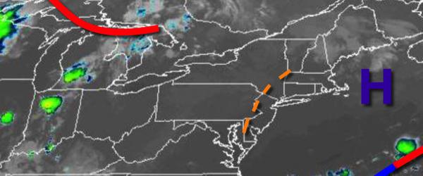
High pressure off the coast and a weak trough over the Delaware River Valley will produce scattered clouds and isolated thunderstorms today on through tomorrow. The thunderstorms will be capable of brief heavy downpours, frequent lightning, hail, and wind gusts over 40 mph. Locally dense fog will be a threat in the morning hours. Winds will be from the southwest at 5 to 10 mph. Temperatures will rise into the mid-80s to lower 90s
for highs this afternoon. Temperatures tomorrow will range from the lower to mid-70s for lows and mid-80s to lower 90s for highs.
A cold front will approach on Wednesday with fog in the morning giving way to scattered showers and thunderstorms in the afternoon. Winds will back to the south at 5 to 10 mph. Temperatures on Wednesday will range from the lower to mid-70s for lows and lower to mid-80s on the coast and mid to upper 80s elsewhere for highs.
The cold front will slowly sink south on Thursday and Friday with broken to overcast cloud cover and scattered showers. Temperatures on Thursday will range from the lower to mid-70s for lows and lower to mid-80s for highs. Temperatures on Friday will range from the lower to mid-70s for lows and upper 70s to lower 80s for highs.
High pressure from the Canadian Maritimes will build south on Saturday and Sunday with scattered to broken cloud cover and isolated showers. Temperatures will range from the upper 60s to lower 70s for lows and upper 70s to lower 80s for highs.
A warm front will slowly lift through the region on Monday with periods of showers and thunderstorms capable of heavy downpours at times. Temperatures on Monday will range from the upper 60s to lower 70s for lows and upper 70s to lower 80s for highs.
For details on your location, please visit the Local Seven Day Forecast!