Waves of showers and thunderstorms through the end of the week will usher in a maritime air mass by the weekend as a cold front slowly sinks south.
A cold front will slowly sink south through the region today on through tomorrow with scattered to broken cloud cover and scattered showers and thunderstorms. Winds will back from the south to east at 5 to 15 mph. Temperatures will rise into the mid to upper 80s for highs today. Temperatures tomorrow will range from the lower to mid-70s for lows and upper 70s to lower 80s for highs.
The cold front will continue to sink south on Friday with scattered to broken clouds along with isolated to widely scattered showers. Winds will be from the east at 5 to 15 mph. Temperatures on Friday will range from the lower to mid-70s for lows and lower to mid-80s for highs.
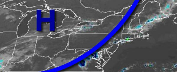
High pressure from the Canadian Maritimes will build into the region on Saturday and Sunday with scattered to broken cloud cover and a few isolated showers. Temperatures will range from the mid-60s to lower 70s for lows and upper 70s to mid-80s for highs.
A warm front will lift through the region on Monday with scattered to broken cloud cover with isolated showers. Temperatures on Monday will range from the mid-60s to lower 70s for lows and upper 70s to lower 80s for highs.
A cold front will follow on Tuesday with scattered showers and thunderstorms. Temperatures on Tuesday will range from the upper 60s to lower 70s for lows and mid-80s for highs.
High pressure will follow on Wednesday with clear skies to scattered cloud cover. Temperatures on Wednesday will range from the upper 50s to lower 60s over the interior and mid to upper 60s along the coast for lows and upper 70s to mid-80s for highs.
For details on your location, please visit the Local Seven Day Forecast!