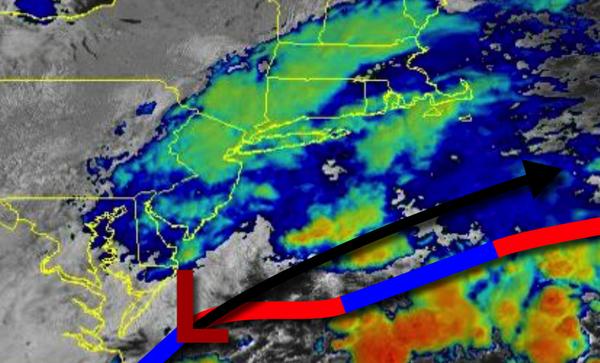
An area of low pressure off the Delmarva Peninsula will continue to produce periods of rain along the New Jersey coast today while the rest of the region dries out.
An area of low pressure will slowly exit off the coast this morning with periods of rain throughout much of the region. Showers will linger over much of the region through the early afternoon for most of the region while steady rain continues along the southern New Jersey coast. Rainfall amounts around 1.0" can be expected over southeastern New Jersey. Winds will back from the northeast to the north at 5 to 15 mph. Temperatures
will rise into the upper 60s to mid-70s for highs.
A cold front will approach tomorrow afternoon through Tuesday morning with scattered to broken clouds and isolated showers. Skies will clear by Tuesday afternoon. Winds will back to the west at 5 to 15 mph. Temperatures tomorrow will range from the upper 50s to mid-60s for lows and upper 70s to lower 80s for highs. Temperatures on Tuesday will range from the lower to mid-60s for lows and lower to mid-80s for
highs.
A series of weak troughs and cold fronts will produce scattered to broken clouds along with isolated showers Wednesday through Friday with lows in the upper 50s to mid-60s for lows and upper 70s to lower 80s for highs.
A stronger cold front will move through the region on Saturday evening through Sunday morning with scattered showers and thunderstorms. Temperatures on Saturday will range from the mid to upper 60s for lows and lower to mid-80s for highs. Temperatures on Sunday will range from the upper 60s to lower 70s for lows and upper 70s to mid-80s for highs.
For details for your location, please visit the Local Seven Day Forecast!