A series of cold fronts will bring showers and thunderstorms today, but excellent weather returns tonight!
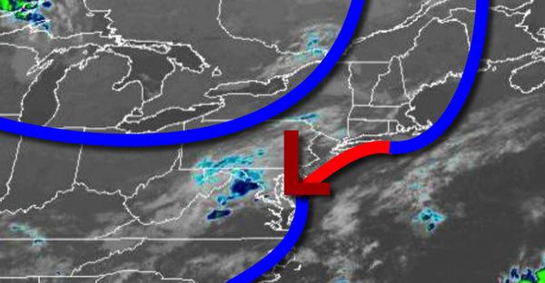
A series of cold fronts will move through the region through this evening with scattered showers and thunderstorms. The thunderstorms will be capable of brief heavy downpours, occasional lightning, and wind gusts over 40 mph. Winds will veer to the northwest at 5 to 10 mph. Temperatures will rise into the mid to upper 70s for highs.
High pressure will build into the region tonight with clearing skies. Winds will be from the north at 5 to 10 mph. Temperatures will fall into the lower to mid-50s over the interior and mid-50s to lower 60s along the coast for lows.
High pressure will settle over the region tomorrow on through Friday with clear skies to scattered cloud cover. Winds will veer from the north to southwest at 2 to 5 mph. Temperatures tomorrow will rise into the mid-70s to lower 80s for highs. Temperatures on Friday will range from the upper 50s to mid-60s for lows and upper 70s to lower 80s for highs.
High pressure will exit the region on Saturday with increasing cloud cover. Temperatures on Saturday will range from the mid to upper 60s for lows and upper 70s to mid-80s for highs.
A weak trough will linger over the region Sunday on through Wednesday with a new tropical air mass invading the region producing areas of fog in the morning and isolated showers and thunderstorms in the afternoon. Temperatures on Sunday will range from the upper 60s to lower 70s for lows and lower to mid-80s for highs. Temperatures on Monday through Wednesday will range from the upper 60s to lower 70s for lows and mid-80s to lower 90s for
highs.
For details on your location, please visit the Local Seven Day Forecast!