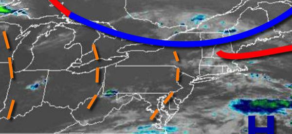
An active weather pattern is on the way for this week with tropical air masses battling cool, dry Polar air masses through the week and into next weekend.
A tropical air mass will be in place today with morning clouds giving way to scattered clouds by noon. A weak trough over the region will support the development of isolated to widely scattered showers and thunderstorms. The thunderstorms will be capable of heavy downpours, frequent lightning, and wind gusts over 40 mph. Winds will be from the southwest at 5 to 10 mph. Temperatures will rise into the lower to mid-80s on the coast
and mid to upper 80s elsewhere for highs.
A cold front will follow tomorrow with low clouds and fog in the morning giving way to scattered showers and thunderstorms in the afternoon and early evening. Skies will clear thereafter. Winds will veer to the west at 5 to 10 mph. Temperatures tomorrow will range from the lower to mid-70s for lows and mid-80s to lower 90s for highs.
High pressure will build south tomorrow night through Wednesday with clear skies to scattered cloud cover. Winds will be from the northwest at 5 to 10 mph. Temperatures on Wednesday will range from the mid to upper 60s for lows and upper 70s to mid-80s for highs.
A warm front will lift north through the region on Thursday with scattered showers and thunderstorms throughout the day. Temperatures on Thursday will range from the lower to mid-60s for lows and upper 70s to mid-80s in the New York City metro and mid-80s to lower 90s in the Philadelphia metro.
A tropical air mass will be in place on Friday with areas of fog in the morning and scattered showers and thunderstorms in the afternoon. Temperatures on Friday will range from the upper 60s to lower 70s for lows and lower to mid-80s along the coast and mid-80s to lower 90s elsewhere for highs.
The remnants of Laura will pass through the region on Saturday ahead of an advancing cold front with periods of rain, heavy at times. Temperatures on Saturday will range from the lower to mid-70s for lows and lower to mid-80s for highs.
High pressure will build into the region Saturday night on through Monday with clear skies to scattered cloud cover. Temperatures on Sunday will range from the upper 50s to mid-60s for lows and mid to upper 70s for highs. Temperatures on Monday will range from the upper 40s to lower 50s over the interior and mid to upper 50s along the coast for lows and lower to mid-70s along the coast and mid to upper 70s elsewhere for
highs.
For details on your location, please visit the Local Seven Day Forecast.