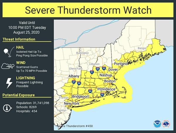
Severe Thunderstorm Watch Number 450
   NWS Storm Prediction Center Norman OK
   310 PM EDT Tue Aug 25 2020

   The NWS Storm Prediction Center has issued a

   * Severe Thunderstorm Watch for portions of
     Connecticut
     Massachusetts
     Eastern Maine
     Southern New Hampshire
     Northeast New Jersey
     Southeast New York
     Rhode Island
     Southern Vermont
     Coastal Waters

   * Effective this Tuesday afternoon and evening from 310 PM until
     1000 PM EDT.

   * Primary threats include...
     Scattered damaging wind gusts to 70 mph possible
     Isolated large hail events to 1.5 inches in diameter possible

   SUMMARY...Clusters of severe thunderstorms will move southeast
   across the watch area through early evening with a risk for damaging
   wind gusts and isolated instances of large hail.

   The severe thunderstorm watch area is approximately along and 60
   statute miles east and west of a line from 25 miles east northeast
   of Augusta ME to 10 miles southwest of Bridgeport CT. For a complete
   depiction of the watch see the associated watch outline update
   (WOUS64 KWNS WOU0).