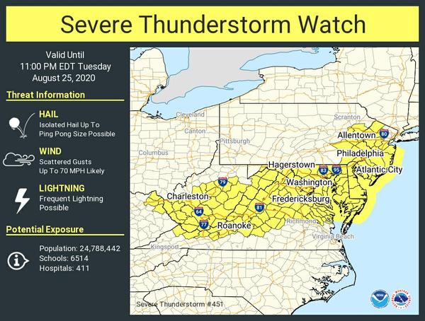
The NWS Storm Prediction Center has issued a

   * Severe Thunderstorm Watch for portions of
     District Of Columbia
     Delaware
     Extreme northeast Kentucky
     Maryland
     New Jersey
     Eastern Pennsylvania
     Central and northern Virginia
     Southern West Virginia
     Coastal Waters

   * Effective this Tuesday afternoon and evening from 335 PM until
     1100 PM EDT.

   * Primary threats include...
     Scattered damaging wind gusts to 70 mph likely
     Isolated large hail events to 1.5 inches in diameter possible

   SUMMARY...Clusters of severe thunderstorms will move southeast
   through this evening with a risk for damaging wind gusts and
   isolated instances of large hail.

   The severe thunderstorm watch area is approximately along and 55
   statute miles north and south of a line from 35 miles west of
   Beckley WV to 50 miles east of Dover DE. For a complete depiction of
   the watch see the associated watch outline update (WOUS64 KWNS
   WOU1).