Waves of rainfall today will give way to a new cool, crisp Polar air mass by tonight and pleasant conditions tomorrow.
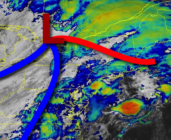
A strong cold front and the remnants of Laura will move through the region today with periods of moderate to heavy rainfall through the early afternoon. Isolated to widely scattered thunderstorms will linger on through the afternoon as the cold front clears the coast. Thunderstorms will be capable of frequent lightning, intense downpours, and wind gusts over 60 mph at times. Winds will veer from the southwest to northwest at 5 to 15 mph.
Temperatures will rise into the upper 70s to lower 80s for highs.
High pressure will build into the region tonight with clearing skies expected. Winds will be from the northwest at 5 to 15 mph. Temperatures will fall into the upper 50s to mid-60s for lows.
High pressure will pass over the region tomorrow on through Monday with clear skies to scattered cloud cover. Winds will veer from the northwest to the northeast at 5 to 10 mph. Temperatures tomorrow will rise into the mid to upper 70s for highs. Temperatures on Monday will range from the upper 40s to mid-50s over the interior and mid-50s to lower 60s along the coast for lows and mid to upper 70s for highs.
A warm front will approach the region Monday night through Tuesday with periods of moderate to heavy rainfall. Temperatures on Tuesday will range from the mid to upper 60s for lows and lower to mid-70s for highs.
The warm front will lift through the region on Wednesday with isolated to widely scattered showers and thunderstorms. Temperatures on Wednesday will range from the upper 60s to lower 70s for lows and upper 70s to mid-80s for highs.
The warm front will stall to the north of the region on Thursday with areas of fog in the morning followed by isolated thunderstorms in the afternoon. Temperatures on Thursday will range from the upper 60s to mid-70s for lows and lower to mid-80s for highs.
A cold front will follow on Friday with isolated to widely scattered showers and thunderstorms. Temperatures on Friday will range from the lower to mid-70s for lows and mid to upper 80s for highs.
High pressure will produce clear skies to scattered cloud cover on Saturday. Temperatures on Saturday will range from the upper 50s to mid-60s for lows and mid-70s to lower 80s for highs.
For details on your location, please visit the Local Seven Day Forecast.