The first day of Fall will feature a cool onshore wind, low clouds, and a few showers. Improving conditions by the Labor Day Weekend is expected.
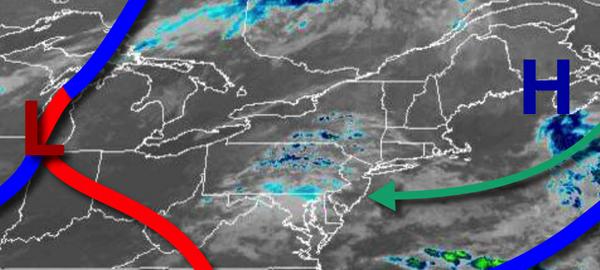
High pressure over the Gulf of Maine and a warm front approaching from the Tennessee River Valley will combine to produce broken to overcast low clouds, drizzle, and isolated showers through this evening. Winds will be from the southeast at 5 to 10 mph. Temperatures will rise into the mid-70s to lower 80s for highs today.
The warm front will lift through the region tomorrow with scattered to broken clouds and isolated to widely scattered showers. Winds will veer from the southeast to southwest at 5 to 10 mph. Temperatures tomorrow will range from the upper 60s to lower 70s for lows and mid-70s to lower 80s for highs.
A cold front approach but weaken over the region on Thursday with areas of fog in the morning and isolated showers and thunderstorms in the afternoon. Winds will be from the southwest at 5 to 15 mph. Temperatures on Thursday will range from the upper 60s to mid-70s for lows and lower to mid-80s along the coast and mid to upper 80s elsewhere for highs.
A stronger cold front will move through the region Thursday night into Friday with scattered showers and isolated thunderstorms. Skies will clear on Friday afternoon. Temperatures on Friday will range from the lower to mid-70s for lows and mid to upper 80s for highs.
High pressure will be in control on Saturday and Sunday with clear skies to scattered cloud cover. Temperatures on Saturday will range from the upper 50s to mid-60s for lows and mid-70s to lower 80s for highs. Temperatures on Sunday will range from the mid-50s to lower 60s for lows and mid-70s to lower 80s for highs.
A warm front will approach on Labor Day Monday with increasing clouds and isolated showers towards evening. Temperatures on Monday will range from the upper 50s to lower 60s over the interior and mid-60s to lower 70s along the coast for lows and upper 70s to lower 80s for highs.
A cold front will move through early on Tuesday with isolated showers followed by clearing skies. Temperatures on Tuesday will range from the mid-50s to lower 60s for lows and mid to upper 70s for highs.
For details on your location, please visit the Local Seven Day Forecast!