An active weather pattern will continue on through the end of the week, but excellent weather conditions are expected by the holiday weekend.
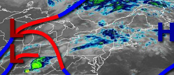
A warm front will approach the region today with increasing clouds along with widely scattered showers and isolated thunderstorms in the afternoon and evening. Winds will veer from the southeast to southwest at 5 to 15 mph. Temperatures will rise into the upper 70s to lower 80s for highs.
The warm front will lift north of the region tonight with broken to overcast clouds along with isolated to widely scattered showers and thunderstorms. Winds will be from the southwest at 5 to 15 mph. Temperatures will fall into the lower to mid-70s for lows.
A cold front will approach and weaken tomorrow with scattered showers and thunderstorms. Winds will be from the southwest at 5 to 15 mph. Temperatures will rise into the mid to upper 80s for highs.
Another cold front will follow on Friday with scattered showers and thunderstorms in the morning followed by clearing skies in the afternoon and evening. Winds will veer to the northwest at 5 to 15 mph. Temperatures on Friday will range from the upper 60s to mid-70s for lows and mid-80s for highs.
High pressure will be in control Saturday on through Labor Day Monday with clear skies to scattered cloud cover. Temperatures on Saturday will range from the upper 50s to mid-60s for lows and mid to upper 70s for highs. Temperatures on Sunday will range from the upper 40s to mid-50s over the interior and mid-50s to lower 60s along the coast for lows and mid-70s to lower 80s for highs. Temperatures on Monday will range from the upper 50s
to mid-60s for lows and mid-70s to lower 80s for highs.
A series of weak troughs will move through the region on Tuesday and Wednesday with areas of fog in the morning and isolated showers and thunderstorms in the afternoon. Temperatures on Tuesday will range from the mid-50s to lower 60s for lows and mid-70s to lower 80s for highs. Temperatures on Wednesday will range from the lower to mid-60s for lows and upper 70s to lower 80s for highs.
For details on your location, please visit the Local Seven Day Forecast.