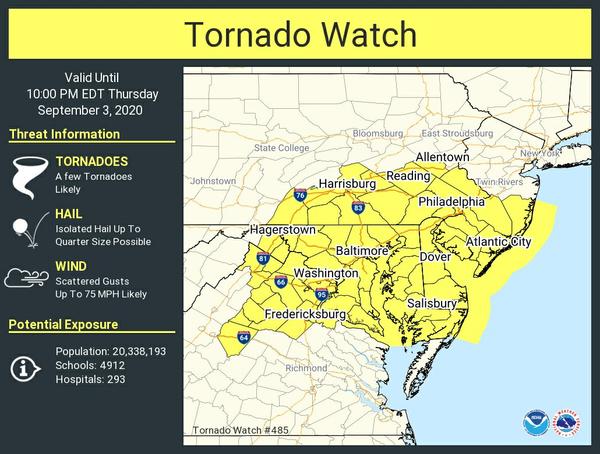
The NWS Storm Prediction Center has issued a

   * Tornado Watch for portions of
     District Of Columbia
     Delaware
     Maryland
     Southern New Jersey
     Southeast Pennsylvania
     Northern Virginia
     Eastern West Virginia Panhandle
     Coastal Waters

   * Effective this Thursday afternoon and evening from 340 PM until
     1000 PM EDT.

   * Primary threats include...
     A few tornadoes likely
     Scattered damaging winds likely with isolated significant gusts
       to 75 mph possible

   SUMMARY...Multiple supercells will likely develop near and north of
   the greater Washington D.C. area and spread east as a cluster across
   the coastal plain through mid-evening. A few tornadoes and swaths of
   damaging winds are likely.

   The tornado watch area is approximately along and 85 statute miles
   east and west of a line from 45 miles north northwest of Wilmington
   DE to 30 miles west southwest of Patuxent River MD. For a complete
   depiction of the watch see the associated watch outline update
   (WOUS64 KWNS WOU5).