After a cold front clears the coast this morning, cooler, drier air will invade this afternoon with clearing skies. Unsettled weather conditions are expected this weekend.
After a cold front clears the region this morning with a few lingering showers, skies will clear as high pressure builds south this afternoon. Winds will veer to the northeast at 5 to 15 mph. Temperatures will rise into the mid to upper 70s for highs this afternoon.
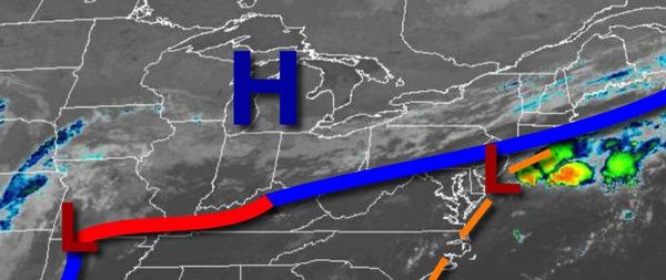
High pressure will pass to the north of the region tonight on through tomorrow with scattered to broken cloud cover expected. Winds will veer to the east at 5 to 15 mph with gusts over 20 mph at times along the coast. Temperatures tomorrow will range from the upper 50s to lower 60s for lows and mid-60s to lower 70s for highs.
An area of low pressure will approach the region on Sunday with a warm front producing scattered showers in the afternoon and evening. Winds will veer from the southeast to southwest at 5 to 15 mph. Temperatures on Sunday will range from the upper 50s to mid-60s for lows and mid to upper 70s for highs.
A cold front will follow on Monday morning with a few showers followed by clearing skies. Temperatures on Monday will range from the upper 60s to lower 70s for lows and upper 70s to lower 80s for highs.
High pressure will be in control Tuesday on through Friday with clear skies to scattered cloud cover. Temperatures on Tuesday will range from the upper 40s to mid-50s for lows and mid-60s to lower 70s for highs. Temperatures on Wednesday will range from the upper 40s to mid-50s for lows and mid-60s to lower 70s for highs. Temperatures on Thursday will range from the mid to upper 50s for lows and mid to upper 70s for highs.
Temperatures on Friday will range from the mid to upper 60s for lows and mid-70s to lower 80s for highs.
For details on your location, please visit the Local Seven Day Forecast!