Excellent weather conditions will be in control through much of this week as a comfortable Fall weather pattern settles in.
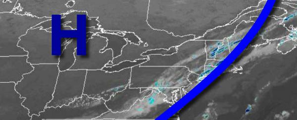
A cold front will exit the coast this morning with an isolated shower or two followed by high-pressure building into the region. Winds will be from the northwest at 5 to 15 mph. Temperatures will rise into the mid to upper 70s for highs this afternoon.
High pressure will be in control tonight on through Wednesday with clear skies to scattered cloud cover. Winds will veer from the north to southeast at 5 to 10 mph. Temperatures tomorrow will range from the mid-40s to lower 50s over the interior and lower to mid-50s along the coast for lows and mid-60s to lower 70s for highs. Temperatures on Wednesday will range from the upper 40s to lower 50s over the interior and mid to upper 50s along
the coast for lows and upper 60s to mid-70s for highs.
High pressure will exit on Thursday with clear skies to scattered cloud cover. Temperatures on Thursday will range from the lower to mid-60s for lows and mid-70s to lower 80s for highs.
A cold front will move through the region on Friday with scattered showers expected. Temperatures on Friday will range from the mid-50s to lower 60s for lows and lower to mid-60s for highs.
High pressure will be in control on Saturday, Sunday, and Monday with clear skies to scattered cloud cover. Temperatures on Saturday will range from the mid-40s to lower 50s for lows and upper 50s to mid-60s for highs. Temperatures on Sunday will range from the upper 30s to mid-40s over the interior and mid-40s to lower 50s along the coast for lows and upper 50s to mid-60s for highs. Temperatures on Monday will range from the mid-40s to
lower 50s for lows and mid to upper 60s for highs.
For details on your location, please visit the Local Seven Day Forecast!