Pleasant weather conditions will continue through much of this week, but the threat of rain will return by next weekend.
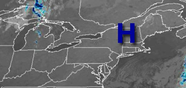
High pressure will remain in control today on through Wednesday with clear skies to scattered cloud cover. Winds will back from the northeast to northwest at 5 to 15 mph. Temperatures today will rise into the lower to mid-60s for highs. Temperatures tomorrow will range from the mid-30s to lower 40s over the interior and mid-40s to lower 50s along the coast for lows and upper 60s to mid-70s for highs. Temperatures on Wednesday will
range from the upper 40s to mid-50s for lows and mid-70s to lower 80s for highs.
High pressure will exit on Thursday with scattered cloud cover. Temperatures will range from the mid to upper 50s for lows and mid to upper 70s for highs.
A cold front will slowly move through the region on Friday with scattered to broken cloud cover and isolated showers. Temperatures will range from the mid to upper 50s for lows and mid-70s to lower 80s for highs.
A warm front will approach on Saturday with isolated showers a threat in the afternoon and evening. Temperatures on Saturday will range from the upper 50s to mid-60s for lows and mid to upper 70s for highs.
A cold front will follow on Sunday and Monday with scattered to widespread showers, heavy at times. Temperatures on Sunday will range from the mid-60s for lows and lower to mid-70s for highs. Temperatures on Monday will range from the mid to upper 60s for lows and mid-70s to lower 80s for highs.
For details on your location, please visit the Local Seven Day Forecast!