A series of cold fronts through tomorrow will keep a threat for showers in play through tomorrow morning. A cool Polar air mass follows for this weekend with the threat of a rainstorm for early next week.
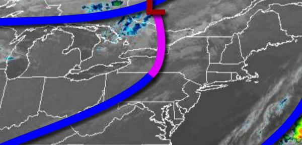
A weak cold front will move through the region today with a few isolated showers in the afternoon. Winds will veer from the west to northwest at 5 to 15 mph. Temperatures will rise into the upper 60s to lower 70s for highs this afternoon.
Another cold front will move through tomorrow morning with a few scattered showers followed by clearing skies in the afternoon. Winds will be from the northwest at 5 to 15 mph. Temperatures tomorrow will range from the upper 40s to mid-50s over the interior and mid-50s to lower 60s along the coast for lows and lower to mid-60s for highs.
High pressure will be in control on Saturday with clear skies to scattered clouds. Winds will be from the west at 5 to 15 mph. Temperatures on Saturday will range from the upper 30s to mid-40s over the interior and upper 40s to lower 50s along the coast for lows and lower to mid-60s for highs.
High pressure will exit on Sunday with increasing cloud cover. Temperatures on Sunday will range from the mid-40s to lower 50s for lows and lower to mid-60s for highs.
An area of low pressure will develop off the coast on Monday with periods of rain and windy conditions in the afternoon and evening hours. Temperatures on Monday will range from the lower to mid-50s for lows and upper 50s to lower 60s for highs.
High pressure will be in control on Tuesday and Wednesday with clear skies to scattered cloud cover. Temperatures on Tuesday will range from the mid-40s to lower 50s for lows and lower to mid-60s for highs. Temperatures on Wednesday will range from the lower to mid-50s for lows and upper 60s to lower 70s for highs.
A cold front will follow on Thursday with scattered showers. Temperatures on Thursday will range from the lower to mid-50s for lows and upper 50s to mid-60s for highs.
For details on your location, please visit the Local Seven Day Forecast!