High pressure shifting off the New England Coast today will set up an onshore flow through much of this upcoming week producing variable clouds and a few pesky showers.
High pressure shifting off the coast will produce scattered to broken cloud cover through this evening. Winds will be from the southeast at 5 to 15 mph. Temperatures will rise into the upper 50s to mid-60s for highs this afternoon.
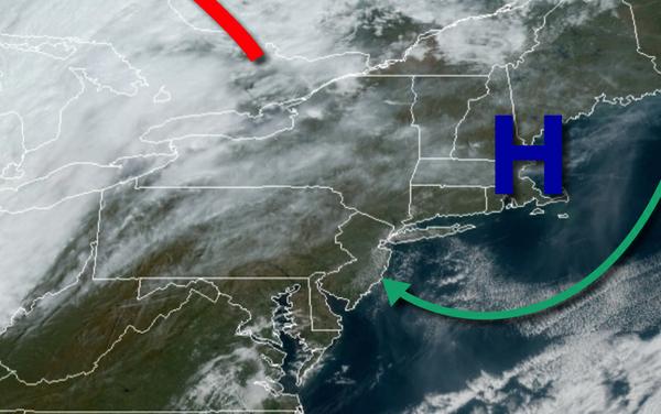
A cold front will approach from the northwest and stall out while high pressure will continue to linger over the coastal waters of New England tomorrow on through Tuesday with variable cloud cover and isolated showers. Winds will be from the southeast at 5 to 15 mph. Temperatures tomorrow will range from the mid-40s to lower 50s for lows and mid to upper 60s for highs. Temperatures on Tuesday will range from the mid to upper 50s for lows
and upper 60s to mid-70s for highs.
Variable clouds and isolated showers will continue to linger over the region from Wednesday through Friday. Temperatures through the period will range from the upper 50s to lower 60s for lows and upper 60s to mid-70s for highs.
A cold front will slowly move through the region on Saturday and Sunday with scattered to widespread showers, heavy at times. Temperatures on Saturday will range from the lower to mid-50s for lows and upper 50s to lower 60s for highs. Temperatures on Sunday will range from the mid-40s to lower 50s for lows and mid to upper 50s for highs.
For details on your location, please visit the Local Seven Day Forecast!