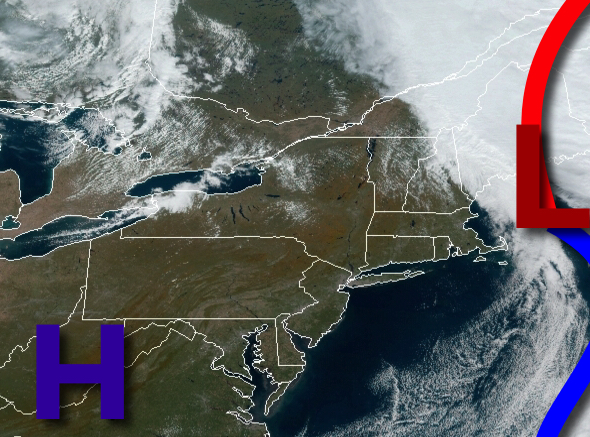
With yesterday's rainstorm leaving the region, excellent weather conditions will be in place for the region this weekend.
High pressure will be in control today on through tomorrow with clear skies to scattered cloud cover. Winds will veer from the northwest to southeast at 5 to 10 mph. Temperatures will rise into the upper 50s for highs this afternoon. Temperatures tomorrow will range from the mid-30s to lower 40s over the interior and mid-40s along the coast for lows and upper 50s to mid-60s for highs.
A cold front will approach on Monday with increasing clouds with a few isolated showers. The cold front will stall over the interior. Winds will be from the southeast at 5 to 15 mph. Temperatures on Monday will range from the mid-40s to lower 50s for lows and mid to upper 60s for highs.
The stationary front will remain northwest of the region Tuesday through Friday with scattered clouds and a few isolated showers. Temperatures on Tuesday will range from the mid to upper 50s for lows and lower to mid-70s for highs. Temperatures on Wednesday will range from the lower to mid-50s for lows and lower to mid-70s for highs. Temperatures on Thursday will range from the upper 50s to lower 60s for lows and lower to mid-70s for
highs.
A cold front will slowly approach the region on Friday with increasing clouds. Temperatures on Friday will range from the upper 50s to lower 60s for lows and upper 60s to mid-70s for highs.
A cold front will move through on Saturday with overcast skies and isolated to widely scattered showers. Temperatures on Saturday will range from the mid to upper 50s for lows and upper 50s to lower 60s for highs.
For details on your location, please visit the Local Seven Day Forecast!