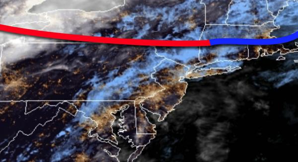
A lingering stationary front has produced areas of fog this morning with visibility below a mile. These conditions will linger on through the rest of the week.
Locally dense fog this morning will lift after 10 AM, giving way to scattered clouds and a few isolated showers this afternoon. Winds will be from the southeast at 5 to 10 mph. Temperatures will rise into the upper 60s to mid-70s for highs.
The stationary front will continue to waver to the north of the region tonight on through Friday with areas of fog in the morning followed by scattered clouds and isolated showers in the afternoon. Winds will veer to the southeast at 5 to 15 mph. Temperatures tomorrow will range from the upper 50s to lower 60s for lows and lower to mid-70s for highs. Temperatures on Friday will range from the upper 50s to lower 60s for lows and mid-60s
to lower 70s for highs.
A cold front will follow on Saturday with scattered clouds and a few evening showers. Temperatures on Saturday will range from the upper 50s to lower 60s for lows and upper 60s to lower 70s for highs.
High pressure will build into the region on Sunday with scattered clouds. Temperatures on Sunday will range from the mid-40s to lower 50s for lows and mid to upper 50s for highs.
A warm front will follow on Monday with a few scattered showers in the afternoon and evening. Temperatures on Monday will range from the mid to upper 50s for lows and upper 60s to mid-70s for highs.
A series of cold fronts will follow on Tuesday and Wednesday with widely scattered to scattered showers expected. Temperatures on Tuesday mid-50s to lower 60s for lows and mid to upper 60s for highs. Temperatures on Wednesday will range from the mid-40s to lower 50s for lows and lower to mid-50s for highs.
For details on your location, please visit the Local Seven Day Forecast.