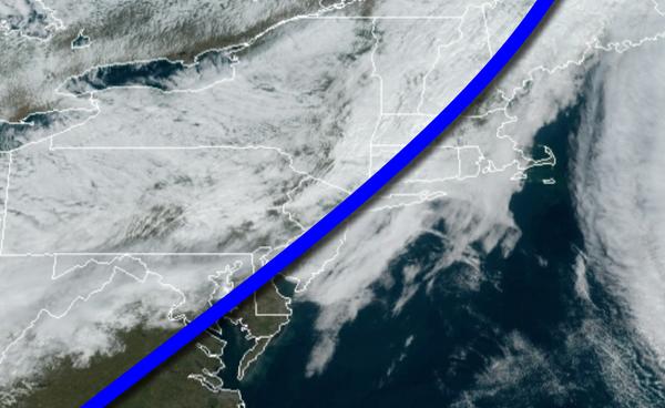
A cold front will put an end to foggy mornings but a few isolated showers will linger through this afternoon. An active weather pattern continues this week.
A cold front will move through the region today with cloudy skies and isolated showers. Winds will veer to the northwest at 5 to 15 mph. Temperatures will rise into the upper 60s to lower 70s for highs.
High pressure will pass to the north of the region tonight through tomorrow with scattered clouds to overcast skies. Winds will veer from the northwest to the northeast at 5 to 15 mph. Temperatures tomorrow will range from the mid to upper 40s for lows and lower to mid-50s for highs.
A warm front will move through the region with broken clouds with isolated showers on Monday. Winds will veer to the southeast at 5 to 15 mph. Temperatures on Monday will range from the upper 40s to lower 50s for lows and upper 50s to mid-60s for highs.
A series of cold fronts will follow on Tuesday and Wednesday with scattered clouds and widely scattered showers. Temperatures on Tuesday will range from the upper 40s to lower 50s for lows and mid to upper 50s for highs. Temperatures on Wednesday will range from the upper 40s to lower 50s for lows and lower to mid-50s for highs.
A series of low-pressure systems will produce periods of rain on Thursday and Friday. The rain will be heavy at times. Temperatures on Thursday will range from the upper 40s to lower 50s for lows and upper 50s to lower 60s for highs. Temperatures on Friday will range from the mid-40s to lower 50s for lows and upper 40s to lower 50s for highs.
High pressure will be in control on Saturday, Halloween, with clear skies to scattered clouds. Temperatures will range from the upper 30s to mid-40s for lows and upper 40s to mid-50s for highs.
For details on your location, please visit the Local Seven Day forecast!