Unsettled conditions will linger through the first half of this upcoming week, but a significant rainstorm is likely by the end of the week.
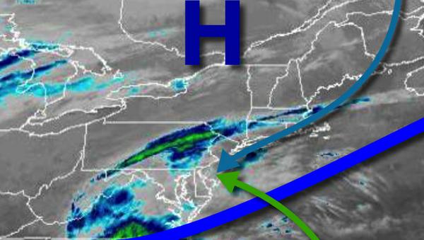
The combination of high pressure to the north and a stalling cold front to the south will produce scattered to broken cloud cover and isolated to widely scattered showers by this afternoon for most of the region. Steady rainfall though will linger over southern New Jersey where up to 0.50" of rain will be possible for locations like Wild Wood and Cape May, New Jersey. Winds will be from the northeast at 5 to 15 mph. Temperatures will rise into
the lower to mid-50s for highs.
A series of weak low-pressure systems will pass through the region tonight through Tuesday with scattered to broken cloud cover and isolated to widely scattered showers. Winds will back from the east to northwest at 5 to 15 mph. Temperatures will range from the upper 40s to lower 50s for lows and upper 50s to lower 60s for highs tomorrow. Temperatures on Tuesday will range from the upper 40s to lower 50s for lows and upper 50s to lower
60s for highs.
Another wave of low pressure will pass to the south of the region with a few isolated to widely scattered showers on Wednesday. Temperatures will range from the upper 40s to lower 50s for lows and upper 50s to lower 60s for highs.
A series of stronger low-pressure systems will pass through the region with waves of moderate to heavy rainfall Thursday through Friday. There is even a chance for a bit of snow to mix in towards the end of the rainfall on Friday, but no accumulation is expected. Temperatures on Thursday will range from the upper 40s to lower 50s for lows and mid to upper 50s for highs. Temperatures on Friday will range from the mid-30s to lower 40s for
lows and lower to mid-40s for highs.
High pressure will be in control on Halloween and Sunday with clear skies to scattered clouds. Chilly conditions can be expected with lows in the upper 20s to mid-30s and highs in the upper 40s to lower 50s on Halloween. Temperatures on Sunday will range from the mid to upper 30s for lows and upper 50s to lower 60s for highs.
For details on your location, please visit the Local Seven Day Forecast.